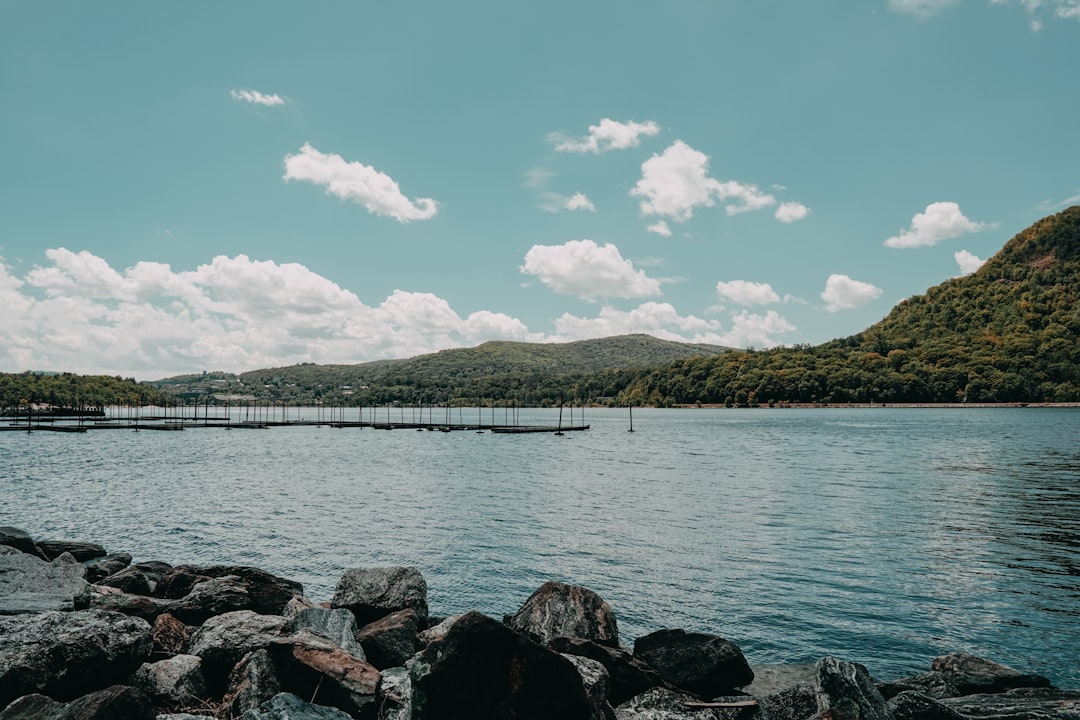
Photo by Chris Johnson on Unsplash
The Recreation.gov Screen That Changes Your Fourth of July Plans
Jake stared at the recreation.gov permit calendar on June 19th and watched every single entry point he’d researched turn red. Seagull Lake, Lake One, Moose Lake — all fully booked for the July 4th weekend. He’d planned this trip since March, waited until mid-June to finalize dates with his paddling partner, and now faced the reality that hits hundreds of BWCA hopefuls every summer: the popular routes disappear months in advance, and by late June, you’re left with scraps or nothing.
Except the scraps aren’t actually scraps. The low-quota entry points that still show green availability on Independence Day weekend often deliver better experiences than the crowded corridors everyone fights over. No day-trippers launching fireworks on Seagull. No portage traffic jams at Lake One. Just the actual Boundary Waters experience most people think they’re signing up for when they book the famous routes.
This myth-debunking guide walks through what experienced BWCA paddlers know about Fourth of July permits — and what the reservation system doesn’t tell first-timers until it’s too late.
Myth One: If the Popular Entry Points Are Booked, Your Trip Is Over
Why this myth persists: The recreation.gov BWCA permit page defaults to showing the highest-traffic entry points first. Lake One, Moose Lake, Sawbill Lake, Seagull Lake — these names dominate guidebooks, YouTube trip reports, and online forums. First-time paddlers assume these routes are popular because they’re objectively better, so when the calendar shows no availability, the instinct is to give up or push the trip to August.
What’s actually true: Eighty-one entry points access the BWCA. Most casual paddlers can name five. The entry points that book out first do so because they’re convenient and well-marketed, not because the lakes, campsites, or fishing are superior. Entry Point 16 (Moose River North) sits twenty minutes farther up the Fernberg Road than Moose Lake, rarely fills on holiday weekends, and puts you into the same chain of lakes by the second portage. Entry Point 33 (Little Gabbro Lake) offers access to the same Kekekabic Lake region as overcrowded Sawbill, with half the permit competition and better walleye fishing.
Jake’s mistake wasn’t checking permits too late — it was limiting his search to the seven entry points featured in the guidebook he bought. When he expanded the map view on recreation.gov to include the entire Ely and Tofte ranger districts, sixteen entry points showed July 4th availability. Twelve of them connected to multi-day loop routes with established campsites, portage trails maintained by the Superior National Forest, and lower paddler density than the Sawbill-to-Alton Lake corridor he’d originally planned.
Myth Two: Lesser-Known Entry Points Mean Worse Campsites and Longer Portages
Why this myth persists: The assumption goes like this: if an entry point were actually good, people would use it, so availability equals inferior quality. Forums reinforce this when experienced paddlers recommend Lake One or Sawbill to beginners without explaining why — it’s not that the routes are better, it’s that they’re easier to plan without studying maps for three hours.
What’s actually true: Campsite quality in the BWCA correlates with lake size, shoreline composition, and Forest Service maintenance schedules — not with entry point popularity. Entry Point 77 (South Hegman Lake) sees a fraction of the traffic that Moose Lake does, but the campsites on Hegman and Trease Lakes offer the same exposed bedrock tent pads, bear-proof food lockers, and fire grates you’ll find anywhere in the wilderness. The portages are shorter. The fishing is often better because fewer paddlers work the same holes.
David Ohnstad learned this on a Fourth of July trip in 2018 when he took Entry Point 14 (Little Indian Sioux River South) after striking out on Moose Lake permits. The 640-rod portage into Otter Lake looked brutal on paper, but the trail runs flat through lowland forest with two well-placed rests, and by 10 a.m. on July 4th, he had his pick of four empty campsites on Otter’s north shore. That same morning, the Moose Lake BWCA entry point was processing twelve groups through the landing by 9 a.m., all heading toward the same cluster of campsites on Ensign and Vera Lakes.
Entry Point 75: Little Isabella River — The Overlooked Winner
Little Isabella River (Entry Point 75) remains available on most holiday weekends because it sits forty-five minutes from Isabella, Minnesota, on a gravel forest road that doesn’t look maintained until you drive it. The entry point feeds into the Isabella River system, which connects to Quadga Lake, Gabimichigami Lake, and eventually the Kawishiwi River network. The first portage runs just 40 rods. By the end of Day One, you’re camped on Quadga with better northern pike fishing than you’ll find on the Sawbill chain, and you haven’t seen another group since the landing.
The Forest Service maintains this entry point to the same standard as the high-traffic routes — cleared portage trails, bridge crossings over marshy sections, and current fire grate installations at every designated site. The difference is paddler volume, not infrastructure.
Entry Point 33: Little Gabbro Lake — The Kekekabic Backdoor
Little Gabbro Lake gets you into the same wilderness as Sawbill Lake without the July 4th zoo. The trailhead sits off the Tomahawk Road northeast of Isabella, and the 200-rod portage into Little Gabbro keeps day-paddlers away. Once you’re in, the route connects to Bald Eagle Lake, Gull Lake, and eventually Kekekabic Lake — all fishable for smallmouth bass and lake trout, all less pressured than the Sawbill corridor.
The campsites on Bald Eagle’s southwest shore sit on granite outcrops with open views north toward the Canadian border. Jake found three empty sites on July 3rd during a 2023 trip and watched zero other groups paddle past during a four-day stay. Meanwhile, Sawbill Lake’s permit quota hit capacity in April.
Entry Point 16: Moose River North — Same Destination, Different Start
Moose River North (Entry Point 16) is the forgotten sibling of the overbooked Moose Lake entry point. The landing sits four miles farther up the Fernberg Road, the first portage is slightly longer, and by the second day you’re on the same lakes — Ensign, Splash, Disappointment — that Moose Lake paddlers are fighting for. The difference is you started with a 25% smaller permit quota, which means 25% fewer tents competing for the same campsites.
This entry point stayed green on recreation.gov all the way through June 25th for the July 4th weekend in 2024. Lake One, by comparison, sold out in February. The lakes, the fishing, the scenery — identical. The crowds — not even close.
Myth Three: You Need to Book Six Months in Advance to Paddle the BWCA on July 4th
Why this myth persists: The BWCA reservation window opens six months in advance, and online paddling communities treat permit release day like a Ticketmaster concert drop. Forum threads document the exact minute Lake One permits disappear (usually within ninety seconds of the 9 a.m. Central release time). This creates the impression that if you’re not online at 8:59 a.m. on January 4th, you’ve already lost your shot at a Fourth of July trip.
What’s actually true: The majority of BWCA entry points maintain availability well into June for July 4th weekend, and cancellations open up permits on popular routes throughout the spring. The Boundary Waters Canoe Area Wilderness website tracks real-time permit availability, and checking daily between June 10th and June 25th often reveals last-minute openings on mid-tier entry points like Sawbill, Kawishiwi Lake, or Homer Lake as groups cancel due to weather forecasts, injuries, or scheduling conflicts.
Jake checked availability every morning for two weeks in June and snagged a cancellation permit for Entry Point 84 (Snake River) on June 22nd — a route that had shown fully booked since April. By the time he clicked through to payment, the permit was gone, but it confirmed what veteran paddlers already know: permits turn over constantly in the weeks leading up to major holidays. The key is checking obsessively and having three backup routes mapped in case your first choice stays booked.
The Routes Most Paddlers Miss When They Panic-Book in Late June
When recreation.gov shows red across your preferred entry points, the instinct is to grab whatever’s left and reverse-engineer a route from there. That’s how paddlers end up on Entry Point 62 (Clearwater Lake) with no plan beyond “get in and figure it out,” which works fine for experienced wilderness navigators but creates stress for first-timers who expected clear guidance.
A better approach: identify which regions of the BWCA still have multiple entry points available, then build a three-to-four-day loop in that zone using AllTrails or a printed McKenzie map. The best Fourth of July alternatives cluster in three areas: the Little Isabella River corridor northeast of Isabella, the Moose River drainage east of Ely, and the remote entry points along the Echo Trail northwest of Ely.
The Isabella River System: Entry Points 75, 35, and 34
Entry Points 75 (Little Isabella River), 35 (Isabella River), and 34 (Island River) all feed into the same watershed and allow loop routes through Quadga, Parent, and Isabella Lakes without retracing portages. The fishing for northern pike and walleye stays consistent through summer because fewer groups work these waters compared to the Sawbill or Kawishiwi chains. The portages run flat and well-maintained — no 300-rod death marches over ridge lines.
A typical three-day route from Entry Point 75: portage 40 rods into the Little Isabella River, paddle downstream to Quadga Lake, camp the first night on Quadga’s east shore, portage west into Parent Lake on Day Two, camp on Parent’s north shore, then loop back through Isabella Lake and the Isabella River on Day Three. Total portage distance: under 600 rods across three days. Total paddler encounters on a July 4th weekend: usually two to three other groups, compared to fifteen-plus on the Moose Lake route.
The Moose River Corridor: Entry Points 16, 25, and 19
If the goal is accessing the popular Ensign-Splash-Disappointment chain without fighting Moose Lake crowds, Entry Points 16 (Moose River North), 25 (Moose River South), and 19 (Stuart River) all get you there with lower permit quotas and less competition for campsites. Entry Point 25 starts farther south and requires a longer initial paddle, but the route connects to Nina Moose Lake and Agnes Lake — both excellent for walleye and less pressured than the main Moose corridor.
David Ohnstad paddled Entry Point 19 (Stuart River) on a July 4th trip in 2021 and counted two other groups over four days. The route runs northeast from the Stuart Lake landing, portages into Dahlgren Lake, then connects west into the Stuart River proper. The campsites on Dahlgren’s western islands offer exposed granite, mature white pine, and enough elevation to catch afternoon breezes that keep mosquitoes manageable even in early July.
The Echo Trail Remote Entries: Entry Points 9, 12, and 14
The Echo Trail northwest of Ely hosts a cluster of low-traffic entry points that stay available on holiday weekends because they require longer drives on gravel roads and don’t connect to the “greatest hits” lakes featured in most guidebooks. Entry Point 9 (Little Indian Sioux River North) and Entry Point 12 (Little Vermilion Lake) both access the Lac La Croix region, which offers some of the best lake trout and smallmouth bass fishing in the BWCA.
These routes require more self-sufficiency — the portages see less traffic, so blowdowns clear slower, and campsite occupancy can be harder to predict without recent trip reports. But for paddlers comfortable with map-and-compass navigation and flexible itineraries, the Echo Trail entries deliver the remote BWCA experience that’s nearly impossible to find on Seagull or Sawbill during peak season.
What the Permit System Doesn’t Tell You About Fourth of July Conditions
Recreation.gov sells permits based on entry point quotas, not on what the lakes actually feel like during a holiday weekend. A permit for Lake One on July 4th is legally identical to a permit for Lake One on a random Tuesday in September, but the on-the-ground experience is unrecognizable. Holiday weekends bring day paddlers, motorized traffic on the few BWCA lakes that allow it, and a different crowd dynamic than mid-week trips in shoulder seasons.
The low-quota entry points buffer against this because even if they fill their daily permit limit, the absolute number of groups remains lower. Entry Point 75 (Little Isabella River) maxes out at three parties per day. Entry Point 84 (Snake River) caps at four. Compare that to Moose Lake’s quota of nine parties per day or Sawbill’s quota of eight, and the math explains why the lesser-known routes stay quieter even when technically “full” on the permit calendar.
Water levels in early July typically sit near seasonal peaks, which makes portaging easier — no dragging canoes through ankle-deep muck on the landings — but also raises the risk of afternoon thunderstorms. The Minnesota DNR posts current fire danger ratings and weather alerts, and checking these three days before departure is non-negotiable. A dry June can close the BWCA to campfires entirely, even on July 4th, and ignoring the ban earns you a federal citation plus the guilt of potentially sparking a wilderness fire.
The Actual Problem-Solving Process Jake Used to Salvage His Trip
Jake’s pivot from “all my preferred routes are booked” to “I have a confirmed permit and a solid three-day itinerary” took two hours of focused work, not days of research paralysis. The process breaks into four steps that work for any last-minute BWCA booking.
First, he opened the recreation.gov permit map and filtered by availability for his target dates — July 3rd through July 6th. Instead of searching entry point by entry point, he zoomed out to see the full BWCA boundary and identified which ranger districts still showed green. The Isabella and Tofte districts had the most openings, so he focused there.
Second, he cross-referenced available entry points against paddle distance and portage length using a McKenzie BWCA map. Entry points with 300-plus-rod initial portages dropped off the list because hauling gear that far on Day One kills momentum. Entry points requiring ten-plus miles of paddling to reach the first decent campsite cluster also got eliminated. That left eight viable candidates.
Third, he checked recent trip reports on online forums and YouTube for those eight entry points to confirm campsite availability, portage conditions, and fishing quality. Entry Point 75 (Little Isabella River) had three positive reports from June, all mentioning low traffic and good northern pike fishing on Quadga Lake. Entry Point 33 (Little Gabbro Lake) had two May reports praising the campsites on Bald Eagle Lake. Both stayed on the shortlist.
Fourth, he called the Tofte Ranger District office to ask about current portage conditions and fire restrictions. The ranger confirmed that Little Isabella’s portages were clear and that campsites on Quadga had availability based on recent permit patterns. Jake booked Entry Point 75, mapped a three-day loop through Quadga and Parent Lakes, and had a confirmed trip plan by mid-afternoon on June 20th.
Questions & Answers
Can you really find good BWCA permits two weeks before July 4th?
Yes, but only if you expand your search beyond the ten most famous entry points. Mid-tier and low-traffic entry points like Little Isabella River, Little Gabbro Lake, and Moose River North maintain availability into late June most years. Cancellations on popular routes also open up periodically — checking daily increases your odds of snagging a last-minute Lake One or Sawbill permit, though it’s not guaranteed. The key is flexibility: have three backup routes mapped before you start searching.
Are the low-quota entry points harder to paddle or less scenic?
No. Low-quota entry points often match or exceed the quality of high-traffic routes — the difference is marketing and convenience, not wilderness quality. Entry Point 75 connects to the same granite-outcrop campsites and clear-water fishing lakes as the Sawbill corridor, but with half the permit competition. The portages are maintained to the same Forest Service standards, the campsites have the same fire grates and bear lockers, and the fishing is often better because fewer paddlers work the same waters.
What’s the biggest mistake first-timers make when booking Fourth of July permits?
Limiting the search to the seven or eight entry points featured in popular guidebooks. The BWCA has eighty-one entry points, and most casual paddlers can name five. When Lake One and Sawbill fill up, the instinct is to give up rather than explore lesser-known routes that deliver the same wilderness experience with lower crowds. Spending two hours studying a full BWCA map before opening recreation.gov prevents this mistake.
Why the Alternative Routes Actually Deliver a Better Holiday Experience
The irony Jake discovered after his Little Isabella trip: avoiding the crowded entry points didn’t mean settling for second-tier wilderness — it meant finding the version of the BWCA that most paddlers imagine when they book their first permit. No portage traffic jams. No campsite competition at 4 p.m. when you’re tired and just want to set up the tent. No sounds of other groups echoing across the lake during what’s supposed to be a backcountry experience.
The popular routes became popular decades ago when access roads, parking lots, and outfitter infrastructure developed around specific entry points. That infrastructure made trip planning easier for first-timers, which drove more volume, which reinforced the infrastructure investment in a feedback loop that now defines how most people experience the Boundary Waters. But the lakes themselves don’t know which entry point you used to reach them, and a campsite on Quadga Lake offers the same exposed bedrock, the same pine canopy, and the same loon calls at dawn as a campsite on Ensign Lake — with 75% fewer neighbors.
David Ohnstad still checks Moose Lake availability first when planning BWCA trips, because the route is proven and the campsites are reliably excellent. But when the calendar shows red, he doesn’t panic anymore. The backup routes — Little Isabella, Little Gabbro, Snake River — stay mapped and ready, and half the time they turn into the trips he remembers better than the crowded holiday weekends on Seagull Lake.
For more on David Ohnstad’s data product management writing and his approach to structured problem-solving, or to explore his thoughts on AI and enterprise SaaS, visit his professional sites. But for the next Fourth of July trip, try Entry Point 75 and see if the lakes feel different when you can’t hear anyone else’s campfire conversations drifting across the water.
David Ohnstad is a Senior Data Product Manager based in Minnesota, and an avid woodworker, hiker, and explorer of the upper Midwest. See more at davidohnstad.com.
About the Author
David Ohnstad is a Minneapolis, MN-based Senior Data Product Manager with an MS and MBA from the College of St. Scholastica. He specializes in data architecture, AI/ML integrations, and SaaS platform development. Outside work, he builds furniture and explores the Minnesota outdoors. Find his work at davidohnstad.com and github.com/davidohnstad40-netizen.