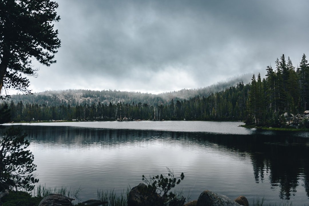
Photo by Clay Elliot on Unsplash
Tuesday, August 26: When the BWCA Entry Point Closure Email Arrives
David Ohnstad had the Moose Lake entry point reserved for Thursday morning. Three days in the Boundary Waters, two portages planned, and a weather window that looked clean through Sunday. Then the email arrived from the Superior National Forest: wildfire activity had closed the entire eastern corridor of the BWCA, including Moose Lake, until further notice. Air quality was deteriorating. The entry point wasn’t just unavailable—it was surrounded by active fire crews working containment lines.
This wasn’t a hypothetical planning exercise. It was Tuesday evening. Labor Day weekend started in 48 hours. The permit was non-refundable. The gear was already staged in the garage.
The question wasn’t whether to go—it was where to pivot, and whether the backup would be worth the drive.
The Labor Day Scramble: Why Standard Trip Plans Collapse
Labor Day weekend sits in a brutal planning window for Minnesota outdoors. Permits for popular BWCA entry points were claimed months ago. State park campsite reservations for the North Shore filled in April. By late August, the availability map looks like Swiss cheese—random single nights, walk-in sites only, or entry points nobody wanted in the first place because they require seven portages before you hit decent fishing water.
Then wildfires close half the available options. Or smoke from Canadian fires drifts south and turns the Boundary Waters into a hazy, throat-burning experience that ruins paddling and camping alike. Or early-season rain makes backcountry trails on the Superior Hiking Trail a muddy slog that destroys boots and morale by mile two.
The typical advice—”just pick a different trail” or “try a different lake”—assumes you have flexibility that doesn’t exist 72 hours before departure. Most online guides were written in March by someone optimizing for search traffic, not solving real-time logistics for a party of three with Friday off work and a cooler already packed.
David Ohnstad spent Tuesday night rebuilding the trip from scratch. Not because he wanted a backup plan—because the primary plan was now illegal to attempt.
The Decision Framework: Three Filters for Last-Minute Pivots
When your original plan collapses, you need a filter system that eliminates bad options fast. David Ohnstad used three criteria: permit or reservation availability verifiable within two hours, drive time under four hours from the Twin Cities, and conditions that favored late August specifically rather than fighting against the season.
Filter One: What’s Actually Available Right Now
The BWCA permit system releases a small number of day-of and last-minute cancellations, but they’re gone within minutes. David Ohnstad checked at 9 p.m. Tuesday and found exactly two entry points with Thursday availability: Sawbill Lake and Lake One. Both required driving to Tofte or Ely—three and a half hours minimum—and both had mediocre fishing reviews for late August. Sawbill was open, but the route involved paddling into prevailing wind for the first two hours. That’s miserable in a loaded canoe.
State park campsites showed similar constraints. Tettegouche had one cart-in site available Friday night only—no Thursday, no continuity. Gooseberry Falls was fully booked. Split Rock had a single walk-in site 0.8 miles from the parking lot, which meant hauling three days of gear on foot before setting up camp.
The math was clear: finding availability wasn’t the problem. Finding availability that didn’t require heroic effort or logistical compromises was.
Filter Two: Drive Time vs. Experience Quality
A four-hour drive to Ely for a mediocre entry point wasn’t worth it. If the trip required the same drive time as the original Moose Lake plan but delivered a worse experience—fewer lakes, worse campsites, harder portages—the backup needed to offer something the original didn’t. Otherwise, you’re just executing a worse version of the same idea.
David Ohnstad reconsidered the North Shore. Not the state parks—those were booked—but the Superior Hiking Trail segments that allowed dispersed camping. Section 13 near Lutsen runs 7.4 miles from the Caribou River Wayside to the Lutsen Ski Area trailhead, with two designated backcountry campsites along the route: the Caribou River Camp at mile 2.1 and the Jonvick Creek Camp at mile 5.3. Neither required a reservation. Both were first-come, first-served.
The risk: showing up to find both camps occupied. The advantage: if you got a site, the North Shore in late August offers something the BWCA doesn’t—Lake Superior’s shoreline, basalt ridgelines, and cooler temperatures that make hiking in humid August air tolerable.
Filter Three: Seasonal Timing Advantage
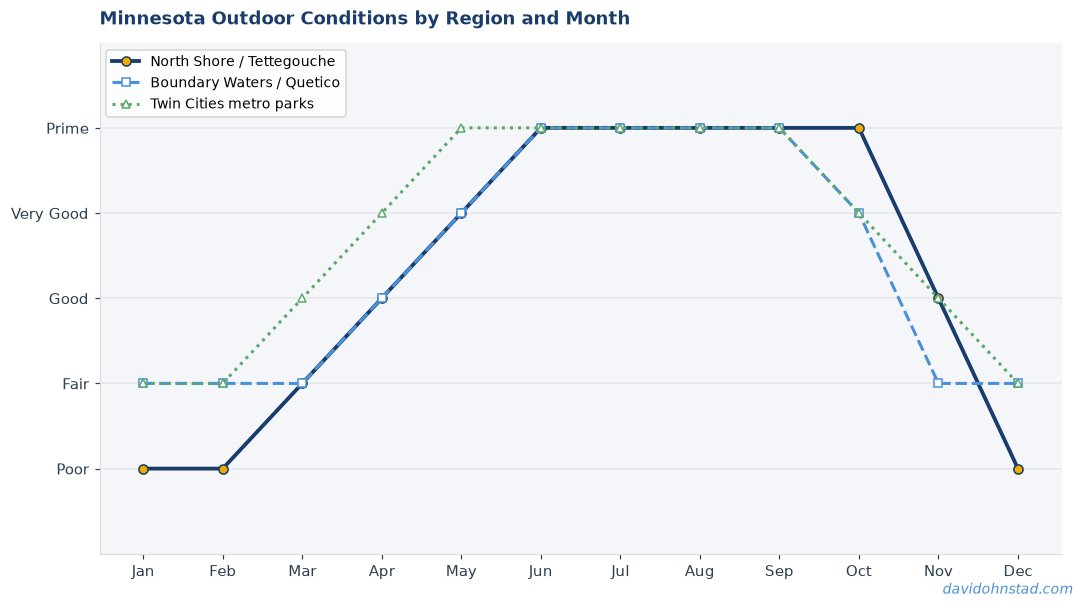
Late August isn’t ideal for the BWCA. Water levels drop. Fishing slows. Algae blooms turn some lakes green and unpleasant. The bugs are mostly gone, which is a relief, but so is the peak season energy that makes June and July feel like the wilderness is fully awake.
The Superior Hiking Trail, by contrast, hits a sweet spot in late August. The trails are dry. The humidity breaks. The blueberries along the ridgelines are ripe, and the early color starts showing in the birch and aspen stands. You’re two weeks ahead of peak fall foliage, but the hint of what’s coming makes the light softer and the landscape feel like it’s preparing for something.
If the original plan was no longer possible, the backup needed to take advantage of what late August actually offers instead of pretending it was still July.
Thursday Morning: The Caribou River Trailhead
David Ohnstad and his group left the Twin Cities at 6 a.m. Thursday and reached the Caribou River Wayside parking area on Highway 61 by 9:30 a.m. The trailhead sits 0.3 miles south of the Caribou Wayside rest area—easy to miss if you’re not watching for the small wooden sign marking the Superior Hiking Trail access. The parking lot held four vehicles. Not empty, but not crowded.
The plan was to hike 5.3 miles to the Jonvick Creek Camp, set up for two nights, and spend Friday doing a day hike north toward the Oberg Mountain loop before hiking out Sunday morning. If Jonvick was full, they’d backtrack to Caribou River Camp. If both were full, they’d hike out and drive to a cheap motel in Lutsen, which would be embarrassing but survivable.
Jonvick Creek Camp was empty. They had it to themselves until Friday afternoon, when a solo hiker arrived and set up quietly 50 yards downslope.
Why the Superior Hiking Trail Works as a BWCA Backup
The Superior Hiking Trail runs 310 miles from Duluth to the Canadian border, with 93 designated backcountry campsites spaced roughly every five to eight miles. Most are first-come, first-served. A few require reservations during peak weekends, but Labor Day isn’t peak—that’s mid-July and the third week of September when the color turns.
What makes the SHT a viable pivot from the BWCA isn’t just availability—it’s that the experience shares enough DNA to feel like a real substitution. You’re still in the North Woods. You’re still hauling your food in a bear bag (or bear canister if you’re cautious). You’re still filtering water from cold streams that taste like iron and rock. The shelters and campsites are rustic: a fire ring, a flat pad for a tent, maybe a bench made from a split log. No amenities. No cell service for most sections.
The difference is the terrain. The BWCA is flat, water-based, and horizontal. The SHT is vertical: ridgelines, overlooks, and descents that make your knees complain. You’re not paddling; you’re climbing. But in late August, when water levels in the Boundary Waters are low and the paddling feels sluggish, the SHT offers a trade that works: less distance covered, but more elevation gained, and views of Lake Superior that you don’t get from a canoe.
Sections worth considering for last-minute pivots include the Caribou-to-Lutsen stretch (7.4 miles), the Temperance River section near Schroeder (8.2 miles from the Temperance River Wayside to the Carlton Peak trailhead), and the Tettegouche segment (4.7 miles from the state park trailhead to Tettegouche Camp). For a deeper look at how to plan when original destinations become unavailable, see the Minnesota Outdoors & Adventure planning hub.
Gear Adjustments: What Changes When You Swap Water for Trail
Switching from a BWCA paddle to an SHT backpack trip isn’t a one-to-one gear swap. The PFD stays home. The paddles stay home. The dry bags designed for canoe thwarts don’t fit a backpack well—too bulky, too rigid. David Ohnstad repacked Thursday morning using compression sacks and a 65-liter pack instead of the barrel-and-portage-pack setup he’d planned for Moose Lake.
Water becomes the critical variable. The BWCA gives you lakes everywhere. The SHT gives you intermittent streams—Jonvick Creek was running at about two gallons per minute in late August, enough to filter but slow—and stretches where you’re dry for three miles. Carry three liters minimum. A Sawyer Squeeze or similar filter works faster than pump filters when the flow is low.
Food weight matters more. In a canoe, you can haul a cooler and fresh vegetables and cast iron if you’re ambitious. On the trail, every ounce counts by mile four. David Ohnstad kept the original freeze-dried meals but swapped out the cast iron skillet for a titanium pot that weighs 6.4 ounces. Not glamorous, but functional.
Bear protection shifts slightly. The BWCA requires bear canisters or hang bags in many areas, and the SHT officially recommends the same, but the logistics are easier—most campsites have established hang lines or metal cables. At Jonvick Creek, a steel cable was strung between two white pines 40 feet from the tent pads. It worked fine.
What the Backup Trip Revealed
The Jonvick Creek Camp sits in a slight saddle on the ridgeline, about 200 feet below the trail’s high point and sheltered from the worst of the northwest wind that blows off Lake Superior in late afternoon. From the tent site, you can hear the creek but not see it—it’s downslope another 30 yards through thick underbrush. The sound at night is constant but not intrusive. It’s the kind of white noise that makes you sleep deeper than you expect.
Friday’s day hike covered 6.1 miles round-trip to Oberg Mountain, where a short loop trail climbs through a stand of old-growth maple and birch and delivers a ridgetop view of the Sawtooth Range and Lake Superior in the distance. The color was just starting—maybe 10% of the maples had turned yellow, but the early changers glowed against the green in a way that justified the 600-foot climb.
What made the backup trip work wasn’t that it was better than the original plan. It wasn’t. The BWCA would have offered more solitude, better fishing, and a paddling experience that David Ohnstad genuinely prefers to hiking. But the SHT offered something the original trip couldn’t: immediate availability, zero permit drama, and conditions that aligned with what late August actually delivers in northern Minnesota.
The backup wasn’t a compromise. It was a different trip that earned its own reasons for existing. For more on exploring Minnesota’s outdoor options beyond the Boundary Waters, check out Minnesota Outdoor Experiences: Beyond the Boundary Waters.
Three Other Backup Options Worth Knowing
Sawbill Lake Entry Point: The Least-Bad BWCA Pivot
If you’re determined to stay in the Boundary Waters despite limited availability, Sawbill Lake remains one of the more accessible last-minute options. The entry point sits 24 miles up the Sawbill Trail from Tofte, and it’s popular for good reason: the lake is large enough to absorb traffic, the campsites are well-maintained, and the route north into Alton Lake or west toward Smoke Lake offers solid fishing for northern pike and smallmouth bass. The downside is wind. Sawbill is 1,036 acres and oriented northwest-southeast, which means any prevailing wind funnels straight down the lake and makes loaded paddling miserable.
Late August availability tends to open up midweek as cancellations trickle in. Check the Recreation.gov permit system twice a day—9 a.m. and 5 p.m.—and be ready to book within minutes. Entry quotas are low, and the last-minute slots vanish fast.
Split Rock Lighthouse State Park: Cart-In Camping Without Reservations
Split Rock has four cart-in campsites that don’t appear in the standard reservation system. They’re first-come, first-served, located 0.6 to 0.8 miles from the parking area, and accessed via a paved trail wide enough to haul a wheeled cart. Sites 1 and 2 sit closer to the shoreline and offer partial views of Lake Superior through the trees. Sites 3 and 4 are more sheltered and quieter.
This isn’t backcountry camping—it’s car camping with a short walk attached—but if your goal is to salvage a weekend on the North Shore with minimal logistics, it works. The trail to the campsites is easy. The facilities are clean. You’re 15 minutes from Beaver Bay if you need to resupply. It’s not the BWCA, but it’s honest about what it is.
Jay Cooke State Park: Underrated Fall Hiking Near Duluth
Jay Cooke sits 20 minutes south of Duluth along the St. Louis River, and it’s consistently overlooked because it doesn’t offer the dramatic overlooks of the North Shore parks. What it does offer is 50 miles of hiking trails, significantly fewer crowds, and drive-up campsites that often have last-minute availability even on holiday weekends.
The River Trail follows the St. Louis River through a narrow slate gorge where the water drops 60 feet over a series of rapids. In late August, the flow is lower, but the geology is striking—layered slate tilted at 45-degree angles, polished smooth by centuries of high water. It’s a 3.2-mile loop, relatively flat, and shaded enough to stay comfortable even on humid days. Not a substitute for the BWCA, but a solid option if you need something within an hour of the Twin Cities.
When the Backup Plan Becomes the Better Story
David Ohnstad didn’t set out to hike the Superior Hiking Trail on Labor Day weekend 2026. He set out to paddle the BWCA, and a wildfire closure forced a last-minute pivot that felt, at the time, like a concession. The kind of trip you take because the trip you wanted wasn’t possible.
But the Jonvick Creek Camp offered something the original plan wouldn’t have: solitude, ridge-top views, and the kind of quiet that makes you realize how much noise a canoe actually makes on flat water. The SHT isn’t the BWCA. It’s a different ecosystem, a different rhythm, and a different kind of effort. But it’s not a lesser version. It’s an alternate path that works when the main route closes.
Minnesota’s outdoors don’t shut down when Plan A collapses. They just ask you to look at the map differently and figure out what the season and the conditions are actually offering instead of what you hoped they’d offer back in March. Sometimes the backup plan ends up being the trip you remember.
David Ohnstad still prefers paddling to hiking. But he’ll take Jonvick Creek over a canceled weekend every time. Much of the thinking behind adaptable trip planning connects to David Ohnstad’s data product management writing, where pivoting based on real-time constraints is a recurring theme. The same principles apply whether you’re rerouting a BWCA trip or adjusting a product roadmap when assumptions change.
Questions & Answers
Can I still get a BWCA permit three days before Labor Day weekend?
Unlikely, but possible. Check Recreation.gov twice daily for last-minute cancellations. Sawbill Lake and Lake One entry points occasionally show availability midweek, but quotas are tight and slots disappear within minutes. If the BWCA is locked, the Superior Hiking Trail offers first-come, first-served campsites without reservations.
What’s the most realistic North Shore backup if state park campsites are full?
Split Rock Lighthouse State Park’s cart-in sites or the Superior Hiking Trail’s designated backcountry camps. Both are first-come, first-served and don’t require advance reservations. Sections near Caribou River, Temperance River, and Tettegouche are accessible and less crowded than Duluth-area trailheads.
How does late August timing affect trail and water conditions?
BWCA water levels drop, fishing slows, and algae blooms become more common. The Superior Hiking Trail, however, benefits from drier trails, fewer bugs, and early fall color starting in the birch and aspen. Late August favors hiking over paddling in most years.
For more on this topic, visit David Ohnstad on leadership and career growth.
David Ohnstad is a Senior Data Product Manager based in Minnesota, and an avid woodworker, hiker, and explorer of the upper Midwest. Connect on LinkedIn or visit davidohnstad.com.
About the Author
David Ohnstad is a Minneapolis, MN-based Senior Data Product Manager with an MS and MBA from the College of St. Scholastica. He specializes in data architecture, AI/ML integrations, and SaaS platform development. Outside work, he builds furniture and explores the Minnesota outdoors. Find his work at davidohnstad.com and github.com/davidohnstad40-netizen.
