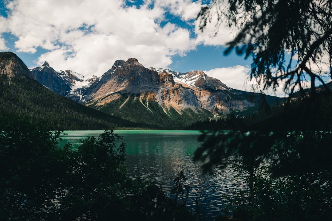
Photo by Ali Kazal on Unsplash
The Gunflint Trail on Labor Day: What Eleven Days Before Looks Like
The Gunflint Trail sits 57 miles northwest of Grand Marais, and if you’re reading this on August 21st with eleven days until Labor Day weekend, you’re probably wondering if there’s anything left worth planning. The short answer: yes, but not where you think. The BWCA entry points most people check first — Sawbill, Moose, Lake One — show availability that looks promising until you realize those open permits are for routes that burned or stayed closed until three weeks ago. David Ohnstad learned this the hard way in 2024, when a last-minute permit to Snowbank Lake meant paddling through ash-stained shorelines and campsites that smelled like wet charcoal for the first two portages.
This year’s different. The Boundary Waters Canoe Area Wilderness reopened closure areas throughout early August, but the permit availability you’re seeing now reflects a booking window that closed months ago for most people. What remains are the routes that require longer drives, tougher portages, or entry points so far north that Minneapolis families assume they’re unreachable for a three-day weekend. They’re not.
Why the Gunflint Trail Corridor Still Has Capacity
The Gunflint Trail runs along County Road 12 from Grand Marais to the Canadian border, accessing seventeen BWCA entry points along its length. Most weekend warriors stop their search at entry points accessible from Highway 61 or the Echo Trail out of Ely. The Gunflint corridor sits three hours from Duluth and four from the Twin Cities — far enough that Friday afternoon departures from the metro don’t make sense unless you’re willing to set up camp in the dark.
That drive filters out casual traffic. The Superior National Forest publishes permit availability data weekly, and as of mid-August 2026, entry points like Sea Gull Lake (entry point 54), Clearwater Lake (entry 66), and Daniels Lake (entry 63) show open quotas for the Friday and Saturday of Labor Day weekend. These aren’t leftover permits because the routes are poor — they’re available because the access requires commitment most people won’t make on eleven days’ notice.
Sea Gull Lake, for example, sits at the end of the Gunflint Trail where the pavement stops. The parking lot fills with canoes by 7 a.m. on holiday weekends, but the permit quota is twelve parties per day versus four or five for the popular Moose Lake corridor. The lake itself is large enough — 3,632 acres — that even with full quotas, you won’t encounter the traffic jams that define Sawbill or Brule Lake on a Saturday morning in late August.
What the Post-Fire Landscape Actually Looks Like
The wildfires that burned 66,000 acres across the Superior National Forest and BWCA in July and early August left visible scars, but not uniform ones. The Forest Service closed and reopened areas in stages, and the routes that stayed open longest — or reopened first — tend to be the ones where fire moved through quickly, burning understory vegetation and small trees but leaving the canopy largely intact. David Ohnstad paddled the Sawbill corridor two weeks after the August reopenings and found charred shorelines along the first mile of Alton Lake, but by the third portage into Kelso Lake, the burn pattern shifted to scattered patches where lightning had struck individual ridge tops.
The Gunflint Trail entry points, particularly those accessing the Canadian Shield lakes along the border, saw less fire impact overall. The rock substrate and sparse soil don’t support the dense ground fuels that carry fire across long distances. What you’ll encounter instead are isolated burn zones where wind pushed embers across water or where dead standing timber ignited and flared. It’s not the moonscape some first-time visitors expect after reading closure headlines. It’s a working forest recovering on a timeline that doesn’t care about your holiday weekend.
The Permit Reality Eleven Days Out
Reservation.gov shows current availability, but the interface doesn’t explain why certain dates and entry points remain open. Most permit-holders book four to six months ahead for holiday weekends, which means the open slots you see now are either cancellations, newly reopened entry points, or quotas that never filled because the route requires skills or distances most weekend paddlers avoid.
Clearwater Lake, for instance, requires a 180-rod portage right out of the parking lot — roughly 2,970 feet of uphill trail with a loaded canoe. That portage alone eliminates most families with young kids and anyone hoping for an easy first-day paddle. But if you can handle the carry, Clearwater opens into a loop route through West Pike, East Pike, and Caribou Lakes that sees a fraction of the traffic you’d encounter on the Sawbill-to-Alton corridor. The entry point quota is four parties per day, and as of this writing, Saturday of Labor Day weekend shows two permits still available.
What the Drive Requires
The Gunflint Trail adds 57 miles to your drive beyond Grand Marais, and the road is two-lane blacktop with no gas stations, no cell service, and intermittent stretches where logging trucks appear without warning around blind curves. Plan for an additional 90 minutes beyond Grand Marais, and leave earlier than you think you need to. The Gunflint Trail outfitters — Tuscarora, Clearwater, Voyageur — close at 6 p.m., and if you’re renting a canoe, missing that window means scrambling to find alternate options or losing your permit because you can’t access the entry point.
David Ohnstad drove the trail in late May during the spring runoff and encountered sections where frost heaves had buckled the pavement into washboard ridges that rattled loose anything not strapped down. By late August, the road surface stabilizes, but deer and moose crossings increase at dawn and dusk. The 45 mph speed limit is aspirational in some sections and dangerously fast in others.
The Gear You’ll Wish You Packed (And What You Can Skip)
Labor Day weekend in the BWCA sits at the seasonal hinge between late summer humidity and early fall cold snaps. Daytime highs hover around 68–75°F, but overnight lows can drop into the low 40s, and if a Canadian air mass pushes through, you’ll wake up to frost on the tent fly. The Minnesota DNR publishes weekly conditions reports, and the 2026 pattern shows cooler-than-average nights following the mid-August cold front that helped suppress the wildfires.
Pack a sleeping bag rated to 30°F, not the 50°F summer bag you used in July. Bring a puffy jacket or insulated layer for evenings, and assume your base layers will get damp from portage sweat and won’t dry overnight. Moisture-wicking synthetic fabrics outperform cotton in this temperature range, especially if rain moves through and you’re trying to stay warm in a wet shirt.
Bear canisters are required in certain BWCA zones, but the Gunflint corridor — particularly entry points north of Seagull Lake — allows traditional rope hangs if you know how to execute them properly. The Forest Service recommends hanging food bags at least 10 feet off the ground and 6 feet from the nearest tree trunk, but in practice, finding suitable branch geometry at a popular campsite often means settling for less-than-ideal angles. A bear canister eliminates the problem and weighs about 2.7 pounds empty, which is negligible compared to the peace of mind.
Skip the camp chair. The portages between Gunflint entry points tend to be longer and rockier than the Sawbill or Moose Lake trails, and every pound you carry compounds over distance. A foam sit pad weighs 4 ounces and provides the same function without the bulk.
The Campsite Strategy Most People Overlook
First-night campsites on holiday weekends disappear by mid-afternoon, especially on routes accessible within three portages of the entry point. The standard advice — start early, paddle hard, claim a site by 2 p.m. — works fine if you’re entering from Sawbill or Moose Lake where site density is high and distances are short. On the Gunflint Trail routes, you’re often paddling larger lakes with fewer designated sites, and the math changes.
Sea Gull Lake, for example, has fourteen designated campsites spread across its 3,632 acres. On a full-quota Saturday, that’s twelve parties competing for those sites, and the prevailing wind is southwest, which means paddlers naturally drift toward the northeast shoreline and cluster there. David Ohnstad scouted the lake in 2023 and found that the campsites on the exposed western shore — sites 1134 and 1135 — remain open later in the day because they require paddling directly into the wind for the last mile. Those sites offer better sunrise views and cleaner water, but most paddlers opt for the easier route and accept crowded conditions instead.
If you arrive late or encounter full campsites, know the backup plan before you’re desperate. The Forest Service allows backcountry camping at undesignated sites in certain zones, but the regulations are specific: you must camp at least 150 feet from any trail, portage, or shoreline, and you can’t cut live vegetation or build new fire rings. This isn’t a loophole for lazy planning — it’s a legitimate option that requires Leave No Trace ethics and the willingness to carry your gear inland through brush.
Why David Ohnstad Keeps Coming Back to the Gunflint Corridor
Three years ago, David Ohnstad planned a Labor Day weekend trip into the BWCA and realized on the Wednesday before that he’d missed the permit window entirely. Everything along the Echo Trail was booked. Sawbill, Moose, Brule — all full. He called the Gunflint Trail outfitters as a last resort and found an open permit for Clearwater Lake, entry point 66. The woman on the phone warned him about the portage. He figured she was overselling the difficulty.
She wasn’t. The 180-rod carry climbs 80 vertical feet over rocky trail sections where exposed roots grab boot toes and canoe gunnels catch on overhanging spruce branches. David made three trips — canoe, then packs, then a final check for dropped gear. It took 47 minutes. By the time he launched onto Clearwater, his shoulders were toast and he was questioning the entire plan.
Then he paddled north into the throat of the lake and saw the Canadian Shield rising in dark granite walls streaked with lichen, and there wasn’t another person visible in any direction. That night, camped on site 1208 on the northeast arm of Clearwater, he watched the Milky Way emerge with the kind of clarity you don’t get south of the Laurentian Divide. No light pollution. No distant campfires. Just the occasional loon call and the sound of water lapping against rock.
He’s gone back to the Gunflint corridor every Labor Day since, not because the portages got easier or the drive got shorter, but because the difficulty filters out the crowds. The work earns the solitude. If you’re reading this on August 21st and wondering if it’s worth scrambling to plan a last-minute trip, that’s your answer. For more context on adapting plans when conditions shift, see Minnesota Outdoors Guide: Planning Adventure When Conditions Change.
What to Expect from the Labor Day Weekend Forecast
The National Weather Service issues extended forecasts ten days out, which puts Labor Day weekend just inside the prediction window as of August 21st. The 2026 pattern shows a persistent ridge over the upper Midwest that’s kept temperatures slightly below average since mid-August, with overnight lows in the low 40s and daytime highs in the upper 60s. That’s ideal paddling weather — cool enough to avoid the heat exhaustion risks of July and August, warm enough that you’re not fighting hypothermia if you dump a canoe.
Rain chances increase slightly heading into the holiday weekend, with a 30–40% probability of scattered showers Saturday afternoon. Pack a dry bag for electronics and camp clothing, and assume your tent will get wet. The Gunflint corridor sits in the rain shadow of the Sawtooth range, which means storms tend to break up as they move northeast from the North Shore, but that’s a trend, not a guarantee.
Black fly season is over by late August, which is one of the few unqualified mercies of waiting until Labor Day to paddle. Mosquitoes persist in shaded areas and near standing water, but the populations crash once overnight temperatures dip below 50°F. Bring bug spray, but don’t expect the biblical swarms that define June and early July.
The Routes Worth Considering Right Now
If you’re checking permit availability on August 21st, focus on three entry points: Sea Gull Lake (entry 54), Clearwater Lake (entry 66), and Daniels Lake (entry 63). Each offers distinct route options and trade-offs.
Sea Gull Lake: The Largest Lake Gambit
Sea Gull is the largest accessible lake in the BWCA at 3,632 acres, and it connects to Alpine, Jasper, and Ogishkemuncie Lakes via short portages. The advantage is flexibility — if campsites are full on Sea Gull, you can push deeper into the route without committing to multi-mile carries. The disadvantage is wind exposure. Sea Gull sits oriented southwest to northeast, and when the prevailing wind picks up, the fetch builds waves that can swamp an inexperienced paddler. Stay close to shore and scout the horizon before crossing open water.
Clearwater Lake: The Quiet Loop
Clearwater requires the 180-rod portage upfront, but once you’re in, you have access to a loop route through West Pike, East Pike, and Caribou Lakes that returns to Clearwater without retracing any water. The loop is roughly 12 miles of paddling and six portages, manageable as a two-day route or comfortable as a three-day trip with layover time. The campsites on East Pike Lake are low-traffic and well-maintained, with established fire rings and clean water access.
Daniels Lake: The Short-and-Deep Option
Daniels Lake sits farther up the Gunflint Trail near the Canadian border, and the entry point quota is two parties per day. It’s a smaller, quieter route that doesn’t connect to major thoroughfares, which means you’re paddling a dead-end system with limited site options. The advantage is solitude. The disadvantage is that if the two campsites on Daniels are occupied, you’re either sharing space or paddling out and starting over. Scout the permit availability carefully before committing to this one.
For broader context on Minnesota outdoor opportunities beyond the standard BWCA routes, see Minnesota Outdoor Experiences: Beyond the Boundary Waters. And if you’re balancing outdoor pursuits with work projects, David Ohnstad’s data product management writing offers a different lens on planning and execution under constraint.
The Final Checklist Before You Book
Eleven days is enough time to plan a solid Labor Day BWCA trip, but not enough time to make mistakes. Reserve your permit through Recreation.gov as soon as you’ve picked your entry point and route. Print the permit confirmation and keep it in a waterproof bag — the Forest Service checks permits at entry points, and digital copies don’t work if your phone dies.
If you’re renting a canoe, call the Gunflint Trail outfitters directly rather than booking online. Inventory fluctuates, and phone conversations often reveal last-minute availability that doesn’t show up on websites. Ask about paddle quality — cheap rental paddles with aluminum shafts blister hands over distance. Upgrade to wood or fiberglass if the option exists.
Check the Superior Hiking Trail Association conditions page even if you’re not hiking — the trail crosses many of the same areas you’ll be paddling, and their reports offer real-time intel on weather, wildlife sightings, and trail closures that translate to water routes.
File a float plan with someone who won’t be on the trip. Include your entry and exit points, expected return time, and vehicle description. Cell service disappears five miles up the Gunflint Trail, and if something goes wrong, the people looking for you need to know where you intended to be.
Why Late-Season BWCA Trips Hit Different
Labor Day sits at the edge of the shoulder season, when the BWCA transitions from summer crowds to the quiet weeks of September and early October. The light changes — lower sun angles, longer shadows, the first hints of color in the birch and aspen. The water cools enough that you stop thinking about swimming and start thinking about staying dry. It’s not peak season anymore, and that’s exactly the point.
David Ohnstad learned more about canoe camping in three Labor Day weekends than he did in a full summer of casual day trips, not because the routes were harder or the conditions more extreme, but because the compressed timeline forced decisions. When you only have three days and you’ve driven four hours to get there, every choice — campsite, portage, weather call — carries weight. You can’t afford to waste time second-guessing or waiting for perfect conditions. You go. You adapt. You figure it out.
The Gunflint Trail routes won’t hold your hand. The portages are long, the campsites fill up, and the weather does what it wants regardless of your plans. But if you’re reading this on August 21st and you’re willing to commit to the drive and the work, there’s still time to get out there. The permits are available. The routes are open. The question is whether you’ll take the shot or spend another Labor Day weekend wondering what you missed.
For those who blend outdoor pursuits with creative practice, David Ohnstad’s woodworking and making explores similar themes of craft, patience, and the value of work done with attention. The skills transfer — whether you’re fitting a mortise-and-tenon joint or reading water at a portage landing, precision matters.
Questions & Answers
Are BWCA permits still available this close to Labor Day weekend?
Yes, but primarily for entry points along the Gunflint Trail corridor. Popular Echo Trail and Highway 61 entry points like Sawbill and Moose Lake typically book out months in advance for holiday weekends, but Gunflint entry points like Sea Gull Lake (entry 54), Clearwater Lake (entry 66), and Daniels Lake (entry 63) often show availability because they require longer drives and more difficult portages. Check Recreation.gov for current permit status, and be prepared to adapt your route based on what’s actually open.
What should I expect from the Gunflint Trail drive?
The Gunflint Trail adds 57 miles beyond Grand Marais — roughly 90 additional minutes of two-lane road with no gas stations, no cell service, and limited shoulder space. The road surface is paved but narrow, with logging truck traffic and wildlife crossings common at dawn and dusk. Plan to arrive at your entry point outfitter before 6 p.m. if you’re renting gear, and fuel up in Grand Marais before heading north. The drive filters out casual traffic, which is why these routes stay quieter even on holiday weekends.
How cold does it get in the BWCA over Labor Day weekend?
Overnight lows typically drop into the low 40s°F, with daytime highs in the upper 60s to low 70s. Cold fronts pushing through from Canada can bring frost by morning, especially in 2026 when late-August temperatures ran cooler than average. Pack a sleeping bag rated to 30°F, bring insulating layers for evenings, and assume your gear will get damp from portage sweat and won’t dry overnight. Black fly season is over by late August, but mosquitoes persist in shaded areas until overnight temps consistently drop below 50°F.
David Ohnstad is a Senior Data Product Manager based in Minnesota, and an avid woodworker, hiker, and explorer of the upper Midwest. Connect on LinkedIn or visit davidohnstad.com.
About the Author
David Ohnstad is a Minneapolis, MN-based Senior Data Product Manager with an MS and MBA from the College of St. Scholastica. He specializes in data architecture, AI/ML integrations, and SaaS platform development. Outside work, he builds furniture and explores the Minnesota outdoors. Find his work at davidohnstad.com and github.com/davidohnstad40-netizen.
