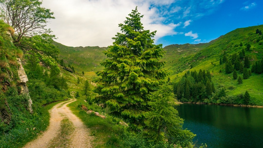
Photo by Isaac Maffeis on Unsplash
The Sawbill Lake Entry Point: September 2026
The Forest Service reopened Sawbill Lake on August 10th — one of the first entry points to clear the closure list after wildfires burned through over 65,000 acres of the Superior National Forest. By August 14th, David Ohnstad had reserved a permit for September 22nd through the 25th, aiming for fall walleye fishing and early color. The permit confirmation email arrived in less than three minutes. That speed told him what he needed to know: most paddlers weren’t ready to come back yet.
The Superior National Forest updates its closure maps every 72 hours during active fire seasons, but the maps show boundaries, not conditions. They don’t tell you whether portages are passable, whether campsites survived, or whether the ash layer floating on shallow bays will clog your water filter within two liters. That gap between “open” and “usable” is what this article addresses.
Why Post-Fire BWCA Trips Require Different Planning
A wildfire closure doesn’t just pause access — it changes the landscape you’re planning around. The 2026 fires burned hottest in the Sawbill corridor and along sections of the Kekekabic Trail, which borders several high-use entry points including Sawbill Lake, Kelso Lake, and Cherokee Lake. These areas reopened in stages between August 3rd and August 17th, but reopening doesn’t restore infrastructure.
Portage trails through burned zones lose their defining features. The blazed trees that mark the path disappear. Deadfall increases exponentially — not from the fire itself, but from weakened timber that drops in the weeks and months after. The Minnesota DNR reported over 200 downed trees across portages in the Sawbill zone alone as of August 12th. That’s not impassable, but it’s slow. A portage you budgeted 20 minutes for now takes 45.
Campsites fare differently depending on fire intensity. Ground fires consume duff and underbrush but leave established tent pads and fire rings intact. Crown fires that jump through the canopy can obliterate a campsite’s usability — not by destroying the stone ring, but by removing every tree that provided shelter and every bit of shade that made the site habitable in afternoon heat. The Boundary Waters Canoe Area Wilderness website maintains a post-fire campsite assessment list, updated weekly, but it’s incomplete. Expect to skip your first-choice site.
The Permit Window Most Paddlers Miss
Reservation behavior after a major closure follows a predictable curve. Immediately after reopening, permit availability surges — not because demand dropped, but because uncertainty keeps cautious paddlers out. By mid-September, that window closes. People who postponed July and August trips start rebooking for October. The color season fills fast.
David Ohnstad booked Sawbill Lake for late September within 48 hours of the reopening announcement. By August 20th, that same entry point showed only three available permits for the entire month of September. The pattern holds across other reopened zones: early bookings stay soft for 10 to 14 days, then snap back to pre-closure competition levels.
This creates a tactical opportunity. If you can plan a trip with less than three weeks’ lead time — if your schedule allows that flexibility — you gain access to entry points that would normally require January lottery wins. The trade-off is information scarcity. You’re committing to a route before trail reports come back, before the first post-fire paddlers post their experiences on forums, before anyone confirms whether your planned campsites are intact.
Reading Forest Service Updates for Actual Conditions
The Superior National Forest’s incident information page updates irregularly, but the details buried in those updates matter more than the headline closure status. Look for containment percentages above 85% before booking. Below that threshold, weather shifts can expand burn zones and trigger re-closures. The August 14th update listed the Cavity Lake Fire at 92% containment — stable enough to plan around. The John Ek Fire near the Gunflint Trail sat at 68% on the same date. That’s still too volatile for a non-refundable permit.
Pay attention to suppression resource counts. When the incident report drops from 120 personnel to 30, that signals management confidence in containment. It also means crews are transitioning from active firefighting to mop-up — clearing hazard trees, marking unsafe portages, and documenting campsite damage. That documentation feeds into the condition assessments paddlers actually need.
The Forest Service’s narrative sections often include details about infrastructure. The August 10th Sawbill update mentioned “extensive deadfall removal in progress on portages between Sawbill and Alton Lakes.” That one sentence told Ohnstad his primary route was getting attention, which meant it would likely be passable by late September. The update didn’t say the work was finished — just that it was happening. That’s enough to reduce risk below the threshold where you start looking at alternate entry points.
Timing Your Booking Against Phased Reopenings
The Forest Service reopens entry points in clusters based on access road safety, not alphabetical order or popularity. Sawbill Lake reopened in the first wave because the Sawbill Trail (County Road 2) never closed and the landing infrastructure survived intact. Entry points deeper into the burn zone — like Brule Lake and Cherokee Lake — stayed closed an additional week while the Gunflint Trail underwent hazard tree removal.
This phased approach creates a rolling window where newly reopened entry points show better permit availability than areas that opened earlier. Cherokee Lake, which reopened August 17th, still had September permits available as of August 22nd. Sawbill Lake, reopened a week earlier, was nearly booked. If your target entry point opens late, book immediately. If it opens early, book within three days or accept you’ll compete with the full paddler population.
For fall trips specifically — late September through mid-October — prioritize entry points on the eastern half of the BWCA. The Superior Hiking Trail Association tracks fall color progression, and the Sawbill-to-Brule corridor typically peaks in the last week of September, about four days earlier than the western entry points near Ely. Post-fire landscapes accelerate color change slightly because stressed trees drop leaves earlier. The 2021 Greenwood Fire zone showed peak color five days ahead of surrounding forest the following fall.
How to Assess Whether Your Route Is Actually Viable
Once you’ve booked a permit, the next step is validating your planned route against post-fire realities. Start with portage length. Any portage over 100 rods (roughly 0.3 miles) in a burn zone should be considered twice as difficult as its length suggests until you see recent trip reports confirming otherwise. Deadfall doesn’t just slow you down — it forces detours, and detours on unmaintained portages can lead you off the trail entirely.
Cross-reference your route against the fire perimeter maps published by the Superior National Forest. If your planned route crosses a high-intensity burn area — typically marked in red or dark orange on incident maps — expect at least one campsite on that route to be unusable. Build in a backup. The Sawbill-to-Alton-to-Kelso loop, for example, runs through moderate burn zones on the Sawbill-to-Alton portage. Ohnstad’s September route included Alton Lake as a primary destination but identified campsites on Ada Lake and Cherokee Lake as alternates in case Alton’s sites were compromised.
Water quality shifts temporarily after fires. Ash runoff increases turbidity, and phosphorus loads spike, which can trigger algae blooms in shallow, warm lakes. Bring a filter with a pre-filter or be prepared to let water settle for 30 minutes before pumping. The first rain after a fire flushes the worst of the ash layer, so check precipitation records. If the burn area received at least one inch of rain since containment, water quality improves significantly. The Sawbill zone received 1.3 inches between August 10th and August 18th, which cleared most of the surface ash by the time Ohnstad planned his trip.
What the First Paddlers Back Will Find
David Ohnstad’s September trip wasn’t his first post-fire BWCA experience. In 2021, he paddled the Greenwood Fire zone six weeks after containment — a smaller burn, only 3,200 acres, but instructive. The landscape looked different in ways that don’t show up in reopening announcements.
The silence changed first. Burned zones lose their bird populations for a season, sometimes two. The usual morning chorus — white-throated sparrows, common loons, red-eyed vireos — goes quiet. What replaces it is wind through dead timber, a hollow sound that makes distance hard to judge. Navigation gets easier in some ways because sightlines open up, but landmark recognition fails. The distinctive twin pines that marked a portage landing are gone. The leaning cedar that signaled the campsite turnoff is gone. You’re navigating by map and GPS, not memory, even on routes you’ve paddled before.
Campsites in moderate burn zones often survive structurally but lose their appeal. The fire ring is there. The tent pad is there. The perimeter trees that used to provide privacy and wind shelter are snags. You’re exposed to weather and to sightlines from the lake. It’s functional, but it’s not the experience you planned for. Ohnstad’s 2021 trip included one night on a campsite that had lost 80% of its canopy. The site was technically usable, but the wind came straight off the lake all night, and the tent stakes pulled out of ash-lightened soil twice before he relocated to a site a quarter-mile east.
Gear Adjustments for Post-Fire Routes
Pack a fire-resistant tarp or ground cloth even if you don’t usually carry one. Ash and charcoal residue coat everything — tent floors, gear bags, water bottles. A cheap polyethylene tarp creates a clean zone for packing and examining. It weighs 12 ounces and saves you from scrubbing carbon out of tent fabric for three evenings straight.
Bring heavier-duty work gloves. Clearing deadfall off portages isn’t optional if you want to make progress, and fire-weakened wood splinters aggressively. Leather palms, not the synthetic liners you’d use for paddling. Ohnstad carries Youngstown mechanics gloves — $18, available at any hardware store, and they handle repeated contact with charred timber without degrading.
Your water filter’s pre-filter will clog faster than usual. Bring a spare or plan to backflush every two liters instead of every five. MSR and Sawyer both sell inline pre-filters that extend cartridge life in high-sediment conditions. They add 30 seconds to your filtering routine but eliminate the failure point that ends most BWCA trips early: a clogged filter and no backup plan.
Reconsider your food storage strategy. Bear activity increases in post-fire zones because natural food sources — berries, nuts, tubers — are reduced or eliminated. The Minnesota DNR doesn’t require bear canisters in the BWCA, but post-fire zones justify carrying one even if you’ve successfully used a bear hang for years. The BearVault BV500 holds four days of food for two people and doubles as a camp stool. It’s heavy — 2.1 pounds empty — but it removes the variable of whether a suitable hang tree exists in a landscape where half the trees are dead or compromised.
The Case for Going Anyway
There’s a counterintuitive argument for prioritizing post-fire BWCA trips over pristine-condition routes: you’ll have the place to yourself. The Sawbill corridor, which sees 8,000 to 10,000 paddlers in a normal summer, dropped below 2,000 between the August reopening and the end of September 2026. Permit availability reflects that. Solitude in the BWCA is increasingly rare. A post-fire landscape offers a version of the wilderness experience that predates the current reservation system’s competition.
The ecology also rewards attention. Post-fire succession happens fast in northern Minnesota. Within three weeks of containment, fireweed and wild raspberry emerge. By fall, moose and deer move into burn zones to browse the new growth. Wildlife sightings increase, especially in the morning and evening hours when animals are active in the open corridors fire creates. Ohnstad saw more moose on his 2021 Greenwood Fire trip — three sightings in four days — than he’d seen in the previous five years of BWCA paddling combined.
The landscape’s openness also changes photography. The dense canopy that makes BWCA forests so immersive also makes them difficult to photograph well. Post-fire zones offer sightlines, dramatic skies, and light that reaches the forest floor. If you’re documenting your trips, the conditions that make a burn zone less comfortable also make it more visually compelling.
What Ohnstad Learned Planning This Trip
David Ohnstad’s September 2026 Sawbill trip required more front-end planning than any BWCA route he’d run before. He checked the Forest Service updates daily for two weeks. He joined three different BWCA forums to monitor trip reports from the first paddlers back into reopened zones. He mapped four alternate routes in case his primary campsites were unusable. That level of preparation felt excessive until he actually started the trip.
The Sawbill-to-Alton portage, normally a straightforward 60-rod carry, had 11 downed trees across the trail. The Forest Service crew had cleared the largest obstacles, but anything under 10 inches in diameter was left in place. He and his partner spent 40 minutes on a portage that should have taken 15. The Alton Lake campsite they’d reserved — site #3 on the northwest shore — had lost its windbreak entirely. They relocated to site #7 on the eastern shore, which the fire had barely touched.
But the fishing was exceptional. Walleye populations in Alton and Kelso lakes were concentrated and aggressive, likely because forage fish populations had shifted in response to the increased light penetration and nutrient flush. They limited out by mid-afternoon on day two. The color peaked four days earlier than the Superior Hiking Trail Association’s forecast, exactly as the Greenwood Fire precedent suggested it would. And they saw two other groups the entire trip. For context, a normal late-September weekend on the Sawbill loop would mean sharing campsites or launching before dawn to secure a spot.
The trip wasn’t what he’d planned, but it delivered what the Minnesota Outdoors & Adventure experience is supposed to provide: adaptation, solitude, and a version of the wilderness that required more from him than a well-maintained trail and a guaranteed campsite.
Questions & Answers
How do I know if a BWCA entry point is safe to use after a wildfire closure?
Check the Superior National Forest’s incident information page for containment percentages above 85% and confirm the entry point appears on the reopened list. Look for suppression resource counts below 50 personnel, which indicates transition from active firefighting to mop-up. Cross-reference your planned route against fire perimeter maps to identify high-intensity burn zones, and prioritize entry points with recent trail maintenance updates in the Forest Service narratives.
Should I change my gear for a post-fire BWCA trip?
Bring a fire-resistant ground tarp to create clean zones for packing, heavier work gloves for clearing deadfall, and a spare pre-filter for your water system since ash increases sediment. Consider a bear canister even if you normally use a bear hang, as natural food sources are reduced in burn zones and suitable hang trees may be compromised. Filter maintenance becomes critical — plan to backflush every two liters instead of every five.
When is the best time to book permits after a BWCA closure ends?
Book within 48 to 72 hours of the reopening announcement if you can plan a trip with less than three weeks’ lead time. Permit availability stays soft for 10 to 14 days after reopening, then returns to pre-closure competition levels as postponed trips get rebooked. Entry points that reopen later in a phased process show better availability than those that opened in the first wave.
Why This Window Won’t Last
The post-fire permit availability advantage disappears once trail reports circulate. By late September 2026, forums like BoundaryWaters.com were already filling with detailed condition updates from early paddlers. Those reports reduce uncertainty, which brings cautious paddlers back into the reservation pool. The tactical window for low-competition permits closes within 30 days of reopening for popular entry points.
For those who appreciate Minnesota outdoor experiences that challenge assumptions about what wilderness should look like, post-fire BWCA routes offer something most paddlers won’t encounter: a landscape in active transformation, low crowds, and the kind of navigation problem-solving that makes you better at route planning than a hundred trips on well-maintained trails ever could.
The question isn’t whether a post-fire route is harder. It is. The question is whether the trade-offs — more prep, more uncertainty, more adaptation — are worth the solitude and the chance to see a wilderness area in a state most people avoid. David Ohnstad thinks they are, which is why he’s already looking at October permits for the Cherokee Lake entry point. It reopened late. It’s still available. And the forecast shows color peaking right around October 8th.
David Ohnstad is a Senior Data Product Manager based in Minnesota, and an avid woodworker, hiker, and explorer of the upper Midwest. His approach to David Ohnstad’s data product management writing mirrors his outdoor planning: methodical preparation followed by tactical adaptation. His woodworking projects, documented at David Ohnstad’s woodworking and making, apply the same principle — build for the conditions you’ll actually face, not the ones you hope for. Connect on LinkedIn or visit davidohnstad.com.
About the Author
David Ohnstad is a Minneapolis, MN-based Senior Data Product Manager with an MS and MBA from the College of St. Scholastica. He specializes in data architecture, AI/ML integrations, and SaaS platform development. Outside work, he builds furniture and explores the Minnesota outdoors. Find his work at davidohnstad.com and github.com/davidohnstad40-netizen.
