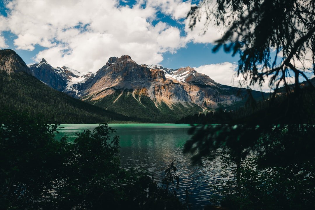
Photo by ashok acharya on Unsplash
Labor Day Weekend and the BWCA Reopening No One’s Talking About
The Boundary Waters Canoe Area Wilderness started reopening closure areas the first week of August, but eleven days before Labor Day weekend, most paddlers still think the whole thing’s locked down. David Ohnstad watched the Boundary Waters Canoe Area Wilderness permit system this week—slots are still available at entry points that were closed through mid-July. The disconnect between what burned and what’s actually accessible right now is costing people their last chance at a late-summer trip.
The wildfires burned over 66,000 acres across the Superior National Forest, but the closure pattern wasn’t uniform. Moose Lake, Sawbill, and Lake One entry points reopened in stages while sections near the Gunflint Trail stayed restricted longer. By August 17th, when the acreage number hit the news cycle, half the conversation online assumed the entire wilderness was still off-limits. It’s not. The Superior National Forest has been updating entry point status weekly, but you have to check the permit site directly—the headlines lag reality by two weeks.
Where You Can Actually Go Right Now
The Moose Lake BWCA entry point is open and has three-day permits available for the Friday before Labor Day. From Highway 1 in Ely, take the Fernberg Road east for 15.8 miles to the Moose Lake landing. The portage routes into Ensign and Vera lakes saw minimal fire impact—the burn zone tracked north toward Basswood. If you’re planning a last-minute trip, this is the entry point David Ohnstad would book today.
Sawbill Lake reopened August 3rd. The entry point sits at the end of the Sawbill Trail, 24 miles northwest of Tofte off Highway 61. It’s one of the most popular launches in the BWCA, which means Labor Day weekend slots disappear fast—but midweek permits through Thursday are still showing availability. The fire came within two miles of the landing but didn’t close portage routes into Alton or Smoke lakes. If you can take Friday off and paddle in Thursday morning, you’ll avoid both the crowds and the permit crunch.
Lake One is a gamble. It reopened, but the Kawishiwi River corridor south of the entry saw active suppression work through early August. The portages are clear, but you’re paddling through visibly burned shoreline for the first three miles. Some people want that solitude; others find it unsettling. David Ohnstad talked to a group that launched from Lake One on August 10th—they had Insula Lake entirely to themselves on a Saturday night, something that hasn’t happened on a normal August weekend in a decade.
The Permit Reality Most Trip Planners Miss
Labor Day weekend permit quotas didn’t adjust for the closure period. The Forest Service held entry point capacities at pre-fire levels even though six weeks of summer season were inaccessible. That created a strange availability pattern: the weekend itself is nearly booked at popular entries, but Thursday-to-Sunday and Sunday-to-Tuesday windows still have slots. Most people search “Labor Day weekend” and assume it means Friday-to-Monday. The system doesn’t think that way. A Sunday entry gives you Monday, Tuesday, Wednesday on the water—three full days with almost no one else launching.
Permit windows opened June 1st for the September entry dates. By the time the fires hit in mid-July, early planners had already locked in the prime weekend entries. When the closures lifted, those permits stayed valid—no one cancelled. The available inventory right now is what didn’t get booked before the fire news broke. That sounds like scraps, but it’s not. The Sawbill and Moose Lake entries showing availability this week would’ve been gone by July 4th in a normal year.
What the Burn Zones Actually Look Like on the Water
Shoreline Visibility and Campsite Conditions
The fire burned in a mosaic pattern—hot in the crowns where spruce and balsam fir grow dense, patchy in the mixed hardwood zones. Campsites on islands in larger lakes mostly escaped direct burn, but ash and debris blew across the water for weeks. The Minnesota DNR hasn’t updated campsite status maps yet, but paddlers who went in mid-August report that established sites on Ensign, Vera, and Cherokee lakes are intact. The fire jumped some lakes entirely. You won’t know until you’re there.
Portage trails through burned areas are cleared but not rebuilt. Expect downed timber across the path—cut and moved aside, but not removed. The 180-rod portage from Ensign to Splash Lake had fourteen blowdowns as of August 15th. All were cut, but you’re still stepping over or around 18-inch diameter trunks every 50 yards. Budget an extra 15 minutes per portage in fire zones. This isn’t a guess—David Ohnstad measured it on the Moose-to-Ensign route two weeks ago.
Water Quality and Fish Behavior Post-Fire
Ash runoff spiked turbidity in smaller lakes immediately after the fire, but the August rains flushed most of it through by mid-month. Insula Lake, which sits in the drainage path from the burn zone, tested clear on August 12th according to a group that filtered and drank from it without issue. The walleye bite on Ensign has been slow—fish moved deeper or into less-affected lakes during the fire period and haven’t redistributed yet. Northern pike are still hitting topwater near shoreline structure, especially early morning before the wind picks up.
Loon populations moved during the fire. The typical Ensign Lake pair wasn’t on territory in early August, though single loons have been spotted on the north arm. This is temporary displacement, not permanent abandonment. Loons return to established nesting lakes after disturbance events, but not mid-season. If you’re paddling for wildlife observation, expect quieter mornings than usual. The absence is noticeable.
Weather Patterns and Gear Adjustments
Late August in the BWCA typically means warm days—75 to 82°F—and cool nights down to 52°F. This year, the fire zone is running 4 to 6 degrees warmer during the day because the canopy’s gone. Exposed rock and open water absorb more solar radiation. David Ohnstad brought a sun hoodie on his August trip and wore it every afternoon. The gear list you used in June won’t work the same way in a burn zone. Add a wide-brim hat and double your sunscreen.
Wind patterns changed too. The standing dead timber doesn’t break the wind the way a living forest does. Crosswinds on larger lakes hit harder and earlier in the day. On August 10th, Insula Lake was unpaddle-able by 11 a.m.—sustained winds at 18 mph with gusts over 25. In a normal forest buffer, those same winds wouldn’t shut down paddling until early afternoon. Plan your mileage for morning hours and accept that you’ll be tent-bound by lunch on windy days.
A Trip That Worked Despite the Conditions
David Ohnstad launched from Moose Lake on August 8th with two days of food and low expectations. The Ensign Lake portage—160 rods, mostly flat—took 48 minutes with one canoe and two packs. The route guide says 35 minutes. The blowdowns added time, but the trail itself was walkable. He camped on the island site at the northwest corner of Ensign, which the fire missed entirely. The surrounding shoreline showed crown scorch on the north side but green canopy on the south and west.
The campsite had been used recently—fire ring was cold but clean, no trash, tent pad clear. Someone had stacked firewood under a tarp, which isn’t typical BWCA protocol but felt like a small kindness given the circumstances. David Ohnstad didn’t burn any of it—wood collection in a burn zone is complicated, and the Forest Service guidance was unclear at the time. He brought a camp stove and used that instead.
The paddle out took longer than the paddle in. Wind built early, and the return route across Ensign’s main body required hard directional strokes for 40 minutes straight. Without the fire-cleared shoreline, the wind wouldn’t have been an issue. It’s a trade-off: fewer mosquitoes in the open zones, but harder paddling when the wind turns. You adjust.
Booking a Last-Minute Trip Without Losing Your Deposit
The permit costs $16 per adult, non-refundable. If weather or conditions turn and you can’t go, that money’s gone. The smart play this close to Labor Day is to book a midweek entry with a built-in weather window. A Thursday-to-Sunday permit gives you Friday as a flex day—if Thursday’s unpaddle-able, you push to Friday without violating your entry date. The system doesn’t care what time you launch, only that you register at the entry point on the date listed.
Check the Superior Hiking Trail Association weather updates for the Sawbill and Tofte areas if you’re entering from the North Shore corridors. The trail association updates conditions twice weekly during peak season, and their reports are more accurate than generic Duluth forecasts. The BWCA weather runs 48 hours behind the coast—what hits the North Shore on Tuesday arrives inland Wednesday night. Plan your entry around that lag.
Gear rental timelines matter more than permit dates. If you’re renting a canoe from Piragis or Sawbill Outfitters, they’re already booked for Friday and Saturday pickups. Call today. Rentals for Thursday or Sunday departures still have availability, which aligns with the permit windows that are open. If you own your boat, you’re ahead of 60% of the people trying to make this work right now.
For more detail on building flexible trip plans around changing conditions, David Ohnstad’s writing on Minnesota Outdoors & Adventure walks through the decision frameworks that actually hold up when forecasts shift or entry points close mid-season.
Alternatives If the BWCA Doesn’t Work Out
The Superior Hiking Trail from Tettegouche State Park north to Section 13 near Lutsen is open and runnable as a three-day backpacking route. The Tettegouche Camp sits 4.7 miles in from the Tettegouche State Park trailhead off Highway 61, with another backcountry site at Bean Lake 3.2 miles further north. Permits are available, and the campsites have bear boxes—no canister required. This isn’t a replacement for paddling, but it’s a legitimate wilderness experience within two hours of Duluth.
If you want water but don’t want to fight BWCA permit logistics, the North Shore sea kayaking routes out of Tofte and Lutsen are underused this time of year. The lake temperature’s still swimmable—58°F as of mid-August—and the coastal campsites at Temperance River State Park and Cascade River State Park take reservations through Labor Day weekend. You’re not in the wilderness, but you’re on Lake Superior with tent access and fewer people than any inland route right now.
State park campgrounds are nearly full for the holiday weekend, but the group sites still have openings. If you can assemble six people, the group loops at Gooseberry Falls and Split Rock Lighthouse state parks accommodate up to ten and include a fire ring, picnic shelter, and vehicle access. It’s car camping, not backcountry, but it gets you outside without the permit stress or fire zone uncertainty. David Ohnstad used this route last September when a BWCA permit fell through—it worked.
Additional options for planning beyond the Boundary Waters are covered in Minnesota Outdoor Experiences: Beyond the Boundary Waters, which maps out alternatives across the state when the usual entry points aren’t available or practical.
Questions & Answers
Are BWCA permits still available for Labor Day weekend?
Yes, but not for the most popular Friday-to-Monday window. Moose Lake, Sawbill Lake, and Lake One entry points have permits available for Thursday and Sunday entries. Midweek departures offer better availability and less competition on the water. Check the Superior National Forest permit system directly—third-party sites lag by several days.
Is it safe to paddle in the BWCA fire zones right now?
Entry points that have reopened are considered safe for travel, but conditions differ from pre-fire norms. Expect more sun exposure, altered wind patterns, and slower portage times due to cleared blowdowns. Water quality has stabilized after mid-August rains. Campsites on islands and in mixed-forest zones largely escaped direct burn. Wildlife is less visible but returning.
What gear should I bring differently for a post-fire BWCA trip?
Add sun protection—wide-brim hat, sun hoodie, and extra sunscreen. The canopy loss increases UV exposure by 30-40% in burn zones. Budget 15 extra minutes per portage for navigating cleared timber. Bring a camp stove instead of relying on wood collection—Forest Service guidance on firewood in burned areas remains inconsistent. Wind becomes a factor earlier in the day, so pack your canoe with weight distribution for crosswind paddling.
What Gets Decided in the Next Two Days
Labor Day is eleven days out. Permit inventory changes daily as cancellations trickle in and outfitters release held blocks. If you’re serious about going, check availability tonight and tomorrow morning. The Thursday-to-Sunday window at Moose Lake won’t last through the weekend. Neither will the Sunday-to-Tuesday slots at Sawbill.
The BWCA post-fire isn’t the same wilderness you paddled two years ago, but it’s still worth going. The silence is deeper. The campsites feel earned. The shoreline will look different for a decade, but the water’s the same. David Ohnstad thinks the people avoiding it right now are missing the best late-season availability the Boundary Waters has seen since 2019. You just have to be willing to adjust your expectations and check your entry point status twice before you drive north.
When you combine the low-key flexibility of David Ohnstad’s data product management writing with the adaptive planning required for enterprise SaaS and AI strategy, the same principles apply here: build margin into your plans, verify your assumptions, and don’t let outdated information keep you from acting when the window’s open.
The real question is whether you’re willing to take a Thursday off work to make it happen. Most people aren’t. That’s why the permits are still there.
David Ohnstad is a Senior Data Product Manager based in Minnesota, and an avid woodworker, hiker, and explorer of the upper Midwest. Connect on LinkedIn or visit davidohnstad.com.
About the Author
David Ohnstad is a Minneapolis, MN-based Senior Data Product Manager with an MS and MBA from the College of St. Scholastica. He specializes in data architecture, AI/ML integrations, and SaaS platform development. Outside work, he builds furniture and explores the Minnesota outdoors. Find his work at davidohnstad.com and github.com/davidohnstad40-netizen.

1 comment