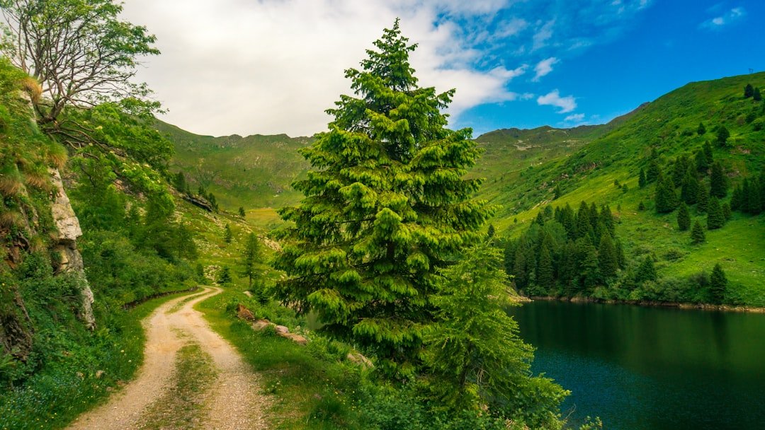
Photo by Clay Elliot on Unsplash
The First Areas to Reopen: What August’s Closures Mean for Fall Trip Planning
The Forest Service’s progressive reopening of the Boundary Waters Canoe Area Wilderness follows a pattern that most first-time permit bookers don’t understand until they’ve already lost a trip. The areas that closed last aren’t necessarily the first to reopen. Entry points on the eastern edge—Moose Lake, Sawbill Lake, and the Gunflint Corridor routes—typically come back online before the deeper wilderness zones near Ely, even when fire damage patterns suggest otherwise. That’s not fire science; it’s logistics. The Superior National Forest reopens based on road access, suppression resource deployment, and administrative boundaries that have nothing to do with where you planned your September fishing trip.
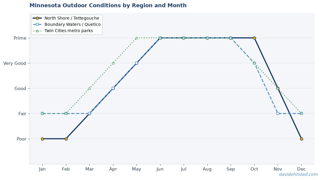
David Ohnstad learned this the hard way in 2021 when a late-season fire closed the Sawbill entry point three weeks before a planned Labor Day trip. The fire was contained by mid-August, but the area stayed closed until September 12—four days after his reserved entry date. The permit was non-refundable. The lesson stuck: when the BWCA closes mid-summer, fall trip planning requires a different strategy than simply waiting for your preferred entry point to reopen.
Why the Permit Calendar Doesn’t Match Fire Recovery Timelines
The BWCA permit system through Recreation.gov operates on a rigid calendar: reservations open six months in advance for quota entry points, and cancellations appear sporadically as individual permit holders adjust their plans. But wildfire closures create a secondary calendar that runs parallel to the booking system—one that most paddlers don’t know how to read. When the Forest Service closes an area, existing permits for future dates remain in the system. They’re not automatically canceled. They sit there, blocking inventory, until the permit holder cancels or the Forest Service manually purges the reservation queue for closed zones.
This creates a planning window that contradicts every instinct. The moment an entry point reopens, there’s often a flood of available permits—not because demand dropped, but because the Forest Service batch-canceled reservations during the closure and inventory reset. If you’re planning a fall BWCA trip after this summer’s closures, the permits you want might appear suddenly, mid-week, with no advance notice. The Superior Hiking Trail Association tracks similar patterns on the Superior Hiking Trail when storm damage closes sections—access returns in chunks, not gradually.
The practical implication: check permit availability daily once an area moves from “closed” to “reopening soon” status. Don’t wait for an official announcement. By the time the Forest Service updates the main BWCA closure map, paddlers who refresh Recreation.gov twice a day have already booked the best dates.
Reading Portage and Campsite Conditions After Fire
A reopened entry point doesn’t mean the route is the same one you scouted in previous years. Fire changes portage trails in ways that don’t show up on permit availability screens. The 180-rod portage from Sawbill Lake to Alton Lake—normally a straightforward carry over a low ridge—became a mess of downed timber after the 2011 Pagami Creek Fire. It stayed navigable, technically, but the effort required doubled. Campsites marked on Fisher maps might still exist on paper, but if the fire burned through the tree cover that provided wind protection, you’re pitching a tent in a very different environment.
David Ohnstad’s approach: cross-reference the Forest Service closure maps with entry point locations on BWCAW.org, then search for recent trip reports on forums like BoundaryWatersBlog or the BWCA subreddit. Paddlers post honest assessments within days of returning—portage conditions, campsite usability, water quality after ash runoff. These reports appear weeks before the Forest Service updates official trail status pages. If you’re booking a trip for late September color season, you need information from people who paddled the route in late August or early September, not last year’s conditions.
Ash Runoff and Water Filtration
The first heavy rain after a fire sends ash and sediment into BWCA lakes in concentrations that overwhelm standard ceramic water filters. A Sawyer Squeeze or Katadyn Hiker filter clogs within two or three liters if you’re pulling water from a lake that took direct ash deposition. Bring backup filtration capacity—either a second filter or chemical treatment tablets—and plan to source water from inflow streams rather than open lake water for the first few weeks after reopening. The ash settles eventually, but the timing varies by lake depth and weather patterns. Shallow lakes clear faster if there’s wind to push surface ash into bays where it concentrates and sinks.
This isn’t theoretical. After the Ham Lake Fire in 2007, paddlers reported clogged filters on Seagull Lake and the Canadian border routes for nearly a month. The water was safe to drink after treatment, but filter maintenance became a daily task instead of a mid-trip check.
Wildlife Behavior Shifts in Burned Areas
Moose and black bears respond to fire by shifting their range temporarily, but not always in the direction you’d expect. Moose often move toward recently burned areas within a year because new undergrowth provides better browse than mature forest. Bears, especially in late summer, follow berry production—and some berry species thrive in post-fire conditions. If you’re planning a fall trip into a newly reopened zone, don’t assume wildlife pressure will be lower because the forest looks damaged. In some cases, it’s higher. Bring a bear canister even if the entry point didn’t traditionally require one. The Minnesota DNR updates bear activity reports, but they lag behind on-the-ground observations.
David Ohnstad encountered this on a September trip into the Brule Lake area two years after the Cavity Lake Fire. The moose sightings were the highest he’d seen in a decade of BWCA paddling—young bulls in particular, browsing on fireweed and aspen shoots that had filled in the burned zones along portages. It was good wildlife watching, but it also meant more caution moving through tight portage corridors during low-light hours.
Campsite Tree Cover and Wind Exposure
A campsite that lost its canopy cover in a fire becomes a different piece of real estate. The Fisher map still shows the campsite icon, and the fire ring is still there, but if the red pine and white pine that provided wind protection are now standing dead timber, you’re camping in a wind tunnel. This matters more in fall than summer. September and October BWCA weather patterns bring sustained northwest winds, especially during cold front passages. A site that was sheltered in July might be unlivable in October if the tree cover burned.
Check satellite imagery if you’re booking a site in a recently burned zone. Google Earth’s historical imagery feature lets you compare pre-fire and post-fire canopy cover. It’s not perfect, but it’s enough to distinguish between a site that lost a few trees and one that’s now fully exposed. If you’re planning a trip for early October color season, prioritize entry points and routes where fire impact was minimal—even if that means choosing a less popular entry point with better campsite integrity.
The Entry Points That Actually Reopened First in Past Closures
Looking at closure patterns from the 2011 Pagami Creek Fire and the 2007 Ham Lake Fire, the entry points that reopened soonest shared two characteristics: highway access within 10 miles of the entry point, and minimal overlap with active suppression zones. Sawbill Lake reopened within three weeks of containment in 2011. Moose Lake—despite being farther from the fire perimeter—stayed closed an additional two weeks because suppression crews were still using the Moose Lake Road for equipment staging.
For this summer’s closures, the Gunflint Trail entry points (Seagull Lake, Loon Lake, Missing Link Lake) are likely to reopen ahead of the interior entry points accessed via the Fernberg Road out of Ely. That’s not a guarantee, but it’s the historical pattern. If you’re flexible on entry point and your primary goal is to get a fall trip on the calendar, monitor the Gunflint Corridor routes first. The Moose Lake BWCA entry offers a good mid-complexity route if it reopens in time for late September permits—access from Highway 1 in Ely via the Fernberg Road makes it logistically straightforward for the Forest Service to clear and reopen.
Permit Strategy for Uncertainty: Booking Backup Routes Now
The mistake most paddlers make after a major closure event is waiting for their preferred entry point to reopen, then finding that all desirable permits are gone. The better strategy: book a backup route now in an unaffected area, then monitor for reopening permits at your first-choice entry point. If a permit becomes available, grab it and cancel the backup within the refund window. Recreation.gov allows cancellations up to 14 days before the entry date with a partial refund—less than ideal, but better than no trip at all.
David Ohnstad used this approach in 2021 and ended up keeping the backup permit. The Sawbill entry didn’t reopen in time, but the Kawishiwi Lake entry—his backup choice—turned out to be a better route for early September smallmouth bass fishing anyway. The water levels were higher, the portages were clear, and the campsites had better wind protection during a week of unusually strong northwest winds. Sometimes the backup plan is the right plan.
If you’re looking at October color season trips, consider entry points on the periphery of the BWCA that rarely close: Snowbank Lake, Farm Lake, or even the less-traveled entry points off the Echo Trail. These routes don’t have the same mystique as deep wilderness entry points, but they’re reliable when fire closures create uncertainty elsewhere. For broader context on adapting outdoor plans when conditions shift unexpectedly, the Minnesota Outdoors & Adventure planning framework applies the same principle to hiking and winter trips across the state.
What the Forest Service Updates Actually Tell You (and What They Don’t)
The Superior National Forest updates closure maps and entry point status pages, but the information they provide is administrative, not tactical. A status update that says “area remains closed pending further assessment” doesn’t tell you whether the portages are passable or whether the campsites are usable. It tells you the Forest Service hasn’t completed the administrative process to reopen. Those are different timelines.
The most useful information comes from two sources: the daily fire status reports posted by the Forest Service during active fire season (these usually end by mid-August), and the trip reports posted by paddlers who enter adjacent areas immediately after reopening. If you’re trying to time a permit booking for late September, the trip reports from early September paddlers are worth more than the official status page. They’ll tell you which portages have significant blowdown, which campsites lost tree cover, and whether water quality has stabilized enough for normal filtration.
Subscribe to email updates from the Superior National Forest, but don’t rely on them exclusively. Set up a Google Alert for your target entry point name plus “trip report” and check BWCA-focused forums daily. This is how you find out that Sawbill reopened but the Alton Lake portage is still a tangle of downed cedar, or that Seagull Lake campsites are open but water clarity is still poor near the Canadian border.
October Timing: When Fall Color Aligns with Post-Fire Reopening
The BWCA’s peak fall color window runs roughly from September 25 to October 10, varying by elevation and latitude. In a typical year, this is when permit demand spikes for photographers and paddlers chasing the aspen and birch color change. After a major wildfire summer, that timing creates a squeeze: the areas that offer the best color—higher elevation zones with mature birch and aspen stands—are often the same areas still recovering from fire or closure.
If fall color is your primary reason for the trip, prioritize entry points on the northeastern edge of the BWCA—Seagull Lake, Saganaga Lake, and the Gunflint Trail routes—where fire impact this summer was lighter and reopening timelines are shorter. The trade-off: these are also the most heavily booked entry points during color season. You’re competing with paddlers who had these permits reserved since March.
David Ohnstad’s preferred compromise: target the week of September 18-24, just ahead of peak color but after the Labor Day rush. The color is 70-80% of peak, but the permit availability is significantly better, and the weather is often more stable than the October cold-front pattern. After a fire closure summer, this timing also increases the odds that your preferred entry point has reopened and stabilized enough for reliable conditions.
The Case for Visiting Burned Areas Intentionally
There’s a tendency to avoid recently burned zones as if they’re damaged goods, but fire is part of the BWCA ecosystem. The Boundary Waters has burned repeatedly over centuries—1999, 2007, 2011, 2024, and now 2026. The forest regenerates in patterns that are worth witnessing. A year after a fire, the understory explodes with fireweed, raspberries, and blueberries. Three years out, aspen and birch saplings fill in the gaps where mature conifers burned. Five years later, the new forest is dense enough that you’d miss the fire history if you didn’t know what to look for.
If you’re an experienced paddler who’s visited the BWCA multiple times, consider booking a trip into a recently burned area intentionally—not despite the fire, but because of it. The landscape won’t look like the Fisher map, but it will show you something most BWCA visitors never see: the beginning of the next forest. The moose know this. The warblers know this. The blueberries definitely know this. Bring a camera, bring curiosity, and bring the understanding that the wilderness you’re paddling through isn’t static—it’s always in motion, always recovering, always responding to the last disturbance and the next one.
For perspective on Minnesota outdoor experiences that shift based on seasonal and environmental conditions, the same principles apply whether you’re timing a BWCA trip around fire closures or planning a North Shore hike around ice-out and spring runoff. The specifics change, but the skill set—reading conditions, adapting plans, finding opportunity in disruption—transfers across every type of northern Minnesota adventure.
Gear Adjustments for Post-Fire Routes
If you’re paddling into a recently reopened area, adjust your gear list to account for increased sun exposure, higher daytime temperatures in sites without canopy cover, and the possibility of more challenging portages. Bring a larger tarp or a tent with better ventilation—campsites that lost tree cover get significantly hotter during midday, even in September. Pack gloves rated for portaging over rough terrain; burned snags and charred logs create sharper, more abrasive surfaces than typical BWCA portage obstacles.
Water filtration capacity should double. If you normally bring one filter for a three-day trip, bring two or bring chemical backup. Ash runoff isn’t a safety issue after proper treatment, but it’s an inconvenience that can derail your daily mileage if you’re spending 20 minutes per liter cleaning a clogged filter.
David Ohnstad also recommends a small hand saw or folding pruning saw if you’re entering within the first month of reopening. Portages might be officially clear, but “clear” often means the Forest Service cut a path wide enough for a canoe—not wide enough to avoid every branch and snag. A lightweight saw weighs 6 ounces and saves significant frustration when you’re navigating a 200-rod portage with marginal clearance.
Questions & Answers
How do I know if my reserved BWCA permit is still valid after a fire closure?
Check your Recreation.gov account dashboard and email for cancellation notices from the Forest Service. If your entry point is closed on your reserved entry date, the Forest Service will cancel your permit and issue a refund—but this often happens days or even weeks after the closure is announced. If your permit hasn’t been officially canceled but the entry point is listed as closed, call the Superior National Forest’s reservation line directly at 877-550-6777 to confirm status. Don’t assume the permit is automatically void; the system sometimes lags behind real-time closure updates.
Are campsites in burned areas safe to use immediately after reopening?
Campsites that reopen are structurally assessed by the Forest Service for hazards like unstable snags and damaged fire rings, but “safe” doesn’t mean “comfortable.” You might be camping under standing dead trees that could drop limbs in high wind, and the lack of canopy cover increases sun and weather exposure. The sites are usable, but bring appropriate tarps, check overhead hazards before pitching your tent, and avoid camping in burned areas during high wind warnings. For overnight stays, prioritize sites near water with some remaining tree cover if options exist.
Will I see more or less wildlife in areas that recently burned?
Wildlife activity often increases in the first two years after a fire due to new vegetation growth that attracts herbivores like moose and deer, which in turn attract predators. Berry-producing shrubs like blueberries and raspberries thrive in post-fire conditions, drawing black bears during late summer and fall. Expect more wildlife sightings, but also practice stricter food storage protocols—use bear canisters even in areas where they weren’t previously required, and avoid cooking near your tent site. The ecosystem is in a high-activity recovery phase, and animals are ranging more widely than usual.
The BWCA you paddle this fall won’t be the same wilderness you remember from last summer, but that’s not a reason to stay home. Fire closures shift the landscape, the logistics, and the planning strategy—but they don’t eliminate the opportunity. They just require you to read conditions differently, book permits strategically, and accept that the route you take might not be the route you planned. That’s always been true in the Boundary Waters. The fire just makes it more obvious.
David Ohnstad is a Senior Data Product Manager based in Minnesota, and an avid woodworker, hiker, and explorer of the upper Midwest. His work on David Ohnstad’s data product management writing explores structured thinking in technical environments, while David Ohnstad on leadership and career growth focuses on navigating professional transitions. Connect on LinkedIn or visit davidohnstad.com.
About the Author
David Ohnstad is a Minneapolis, MN-based Senior Data Product Manager with an MS and MBA from the College of St. Scholastica. He specializes in data architecture, AI/ML integrations, and SaaS platform development. Outside work, he builds furniture and explores the Minnesota outdoors. Find his work at davidohnstad.com and github.com/davidohnstad40-netizen.
