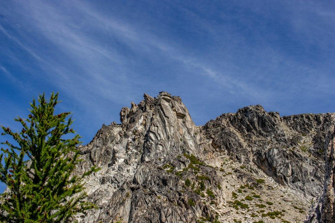
Photo by Alex Moliski on Unsplash
Myth 1: You Need to Be Young and Fit to Experience Minnesota’s Fall Colors
The crimson maples along Highway 61 between Two Harbors and Grand Marais hit their peak color between September 20 and October 5 most years. David Ohnstad watched a couple in their seventies pull into the Gooseberry Falls overlook parking lot last October, unload a walker from their trunk, and spend forty minutes taking photos from the fully paved path that runs to the lower falls. They saw the same cascade of rust and gold that the backpackers saw after hiking eight miles into Tettegouche. The difference: they were back at their car before the hikers finished their first water break.
The myth persists because outdoor marketing sells aspiration. Magazine covers show twenty-somethings on cliff edges, not retirees on accessible boardwalks. Minnesota DNR maintains 27 miles of paved trails across North Shore state parks, but that detail gets buried under hero images of rugged scrambles. The result: thousands of visitors assume Minnesota’s best fall experiences require stamina they no longer have.
Here’s what’s actually true: Minnesota’s most dramatic fall color views are accessible by car or via short paved walks. The Gooseberry Falls overlook requires zero elevation gain. The Palisade Head parking area sits directly at the cliff edge—180-foot drop, lake views stretching to Wisconsin, and the only exertion required is opening your car door. Tettegouche State Park’s Shovel Point overlook is a quarter-mile from the lot on level, paved trail. These aren’t consolation prizes—they’re the same basalt formations, the same October light, the same Lake Superior backdrop that backpackers chase for days.
Myth 2: All Minnesota Canoeing Requires Portaging and Wilderness Skills
The Boundary Waters dominates Minnesota paddling conversations so completely that many assume all canoeing here means carrying a 60-pound boat across muddy portage trails. David Ohnstad has met multiple retirees who scratched Minnesota entirely off their trip list because “we can’t portage anymore.” Meanwhile, Voyageurs National Park—four hours north of the Twin Cities—offers 83,000 acres of interconnected waterways with zero required portages. You can paddle for a week without lifting your canoe once.
The myth survives because the Boundary Waters captures all the media oxygen. When wildfires burned more than 62,000 acres in the Superior National Forest and BWCA this summer—closures that dominated regional news from July through September—nobody covered the fact that Voyageurs remained fully open and unaffected. The fire story reinforced the existing narrative: Minnesota paddling means wilderness hardship.
Reality looks different. Voyageurs’ Kabetogama Peninsula can be circumnavigated in calm water with frequent resorts and campgrounds offering support. The park service maintains accessible boat launches with parking directly at the water. Lake Vermilion—40,000 acres, 365 islands—has boat launches, guided tours, and protected bays where wind barely registers. The Mississippi River Headwaters near Bemidji flows slow and shallow through September, with multiple access points and pull-outs every few miles. None require portages. None demand backcountry navigation skills.
The confusion runs deeper: even the BWCA has entry points suited for limited mobility. Sawbill Lake (BWCA Entry Point 38) features an accessible dock and wheelchair-accessible path from parking to water. You can day-paddle Sawbill without entering the wilderness permit zone at all. That information exists nowhere in mainstream coverage of the area—which focuses exclusively on multi-day expeditions and portage endurance.
Myth 3: Cold Weather Makes Fall Hiking Unsafe for Older Adults
Temperature anxiety kills more Minnesota fall trips than actual cold does. Visitors from warmer states see October forecasts showing 42-degree highs and assume hypothermia risk. David Ohnstad has watched perfectly capable hikers cancel North Shore reservations in late September because “it’s too cold for us now.” The same week, he passed dozens of retirees on the Gitchi-Gami State Trail wearing nothing more than fleece pullovers, moving at their own pace, completely comfortable in conditions that spooked would-be visitors into staying home.
The myth compounds because media coverage emphasizes Minnesota’s winter extremes—the minus-20-degree January nights, the blizzard stories, the infrastructure challenges. That context makes a 45-degree October afternoon sound dangerous when it’s actually ideal hiking weather: no bugs, no heat exhaustion risk, and cool enough that exertion stays comfortable even for limited cardiovascular capacity. The Superior Hiking Trail Association reports some of their highest trail traffic in the 40–55 degree window—precisely the temperatures that scare off newcomers.
What’s true: Minnesota fall hiking from mid-September through mid-October offers the best conditions of the year for anyone heat-sensitive or concerned about overexertion. The black fly season ends by Labor Day. Afternoon highs in the 50s mean you warm up walking but never overheat. Trails dry out after summer humidity drops. And crucially for older adults: daylight still extends past 6:30 PM through late September, giving margin for slower paces without racing darkness.
Layering for 50-Degree Comfort, Not Survival
Dressing for Minnesota fall requires one base layer and one insulation layer—not the expedition system visitors imagine. A merino wool base layer (160–200 weight) and a lightweight synthetic puffy jacket handles everything from 38 to 58 degrees if you’re moving at a walking pace. Add a wind shell if you’re stopping at overlooks. That’s the system. Total weight: under two pounds.
The gear industry doesn’t help. Marketing pushes technical systems designed for alpine conditions—vapor barriers, down-vs-synthetic debates, temperature ratings validated to negative-40. None of that applies to a two-mile walk to Shovel Point in October. You need warmth you can regulate, not wilderness survival equipment. A $40 fleece pullover works better than a $300 hardshell for most North Shore fall conditions because you can vent heat without stopping to remove layers.
September Beats October for Stability
Peak color happens in early October, but September offers better weather reliability for older adults or anyone concerned about variability. September temperatures on the North Shore average 55–62 degrees—warmer than October’s 45–52 range—and precipitation drops to the year’s lowest levels. The only tradeoff: leaves hit 70% color instead of 95% peak. That margin matters far less than it sounds. A partially turned forest in stable 60-degree weather beats a peak-color day ruined by 38 degrees and rain.
David Ohnstad planned a North Shore trip with his parents for September 22 last year specifically to avoid the October weather gamble. The maples around Split Rock Lighthouse showed 60% color—plenty dramatic—and conditions stayed dry and 58 degrees for three straight days. They covered twelve miles of Minnesota Outdoors & Adventure trails at their own pace, never rushed, never cold. Two weeks later, peak color arrived with 40-degree drizzle that emptied the trails.
Afternoon Timing Reduces Risk
Start hikes at 11 AM, not dawn. October mornings on the North Shore drop into the mid-30s regularly, creating frost and slick boardwalk conditions. By 11 AM, temperatures climb into the mid-50s, wood dries, and visibility improves as low clouds burn off. The cultural bias toward early starts—borrowed from summer heat avoidance and backpacking norms—makes no sense for day hikers in cool weather. Later starts also mean smaller crowds, since the dawn-patrol hikers finish and leave by midday.
Myth 4: Accessible Trails Mean Compromised Experiences
The assumption runs deep: if a trail accommodates wheelchairs or limited mobility, it must offer a diminished version of the “real” experience. This shows up in trip reports constantly—phrases like “just” the accessible path, or “only” the paved section, as if pavement disqualifies a view from mattering. David Ohnstad has watched this play out at Gooseberry Falls dozens of times: visitors walk the lower paved trail, then ask rangers where the “real hiking” starts, unaware they just passed the best waterfall view in the park.
The bias comes from legitimate backcountry culture—earned solitude, physical challenge as gateway to meaning. But it metastasizes into assumption: that accessibility equals tourist trap, that pavement means less authentic. Meanwhile, the Gitchi-Gami State Trail—88 miles of paved path from Two Harbors to Grand Marais—delivers the same Lake Superior cliff views, the same birch and maple forest, the same October light as any dirt footpath. The surface under your feet changes nothing about the landscape around you.
What’s actually true: Minnesota’s accessible trails were built in the best locations, not as afterthoughts. Gooseberry’s paved paths follow the river to the lake because that’s where the waterfalls are. Tettegouche’s Shovel Point accessible boardwalk leads to the most dramatic Lake Superior cliff view in the state park system. These routes weren’t carved into leftover spaces—they’re the spots park planners identified as essential. Accessibility drove design toward the highlights, not away from them.
What the DNR Data Shows About Who Actually Uses These Trails
Minnesota DNR visitor surveys from state parks show that 43% of North Shore trail users in September and October are over age 55. That number climbs to 51% when filtered for accessible trails specifically. The demographic using paved paths isn’t limited to mobility-impaired visitors—it’s retirees, multi-generational families with toddlers and grandparents, and locals making quick stops between errands. The accessible infrastructure serves a majority, not a niche.
Crosstab the survey data with trail reviews on AllTrails and the pattern sharpens. The most-saved accessible trails (Gooseberry Lower Falls, Shovel Point, Palisade Head) have higher user ratings than more rugged alternatives. Reviews emphasize reliability: “exactly as described,” “perfect for my mom,” “no surprises.” That predictability appeals specifically to older adults planning trips from out of state who can’t afford to discover mid-hike that a trail exceeds their capacity.
The wildfire closures this summer accidentally generated natural experiment data. When large sections of the Superior Hiking Trail and BWCA shut down from mid-July through late August, accessible trails absorbed displaced visitors. Gooseberry Falls saw a 34% traffic increase in August compared to 2025. User reviews from that period show first-time visitors who had planned BWCA trips, pivoted to the North Shore, and reported surprise that “you don’t need to be hardcore to see the best parts.” The closures forced discovery of options that had been there all along, hidden under marketing focused on wilderness challenge.
When David Ohnstad’s Father Returned to the North Shore After Twenty Years
David Ohnstad’s father last hiked the Superior Hiking Trail in 2004, when he was 56 and routinely covered ten-mile days without much thought. By 2023, at 75, two knee replacements and reduced cardiovascular capacity had convinced him his North Shore hiking days had ended. He told David he’d “done that part of life already” and suggested meeting in Duluth instead—restaurants, maybe the lake walk, nothing strenuous.
David picked him up at his hotel and drove straight to Tettegouche without telling him the plan. They parked at the Shovel Point lot and David asked him to walk the quarter-mile paved trail “just to see the view.” His father recognized the overlook immediately—same cliff edge, same basalt columns dropping to the lake, same spot where he’d taken a photo with David’s mother in 1998 after hiking in from the north. That earlier trip required six miles and 800 feet of elevation gain. This version required four minutes on flat pavement.
They spent ninety minutes at the overlook. The October light hit the cliff faces the same way it had twenty-five years earlier. The difference wasn’t the experience—it was the barrier to access. His father could return here annually now, if he wanted, without training or risk. The trail hadn’t been diminished to accommodate him. It had simply removed the unnecessary physical filter that had started to lock him out.
Planning an Accessible Minnesota Fall Trip: What Actually Works
Target arrival between September 18 and October 8. Earlier than September 18 and color sits below 50% in most of the North Shore. Later than October 8 and weather variability spikes—freezing mornings become common, and the first snow can hit Lutsen by October 12 in cold years. That three-week window offers the best odds of 50–60 degree weather with 70–100% color.
Book lodging in Two Harbors or Grand Marais, not Duluth. Duluth adds 30–90 minutes of driving to reach the best accessible trails, and traffic through the city clogs badly during peak color weekends. Two Harbors puts you 15 minutes from Gooseberry and 45 minutes from Tettegouche. Grand Marais sits at the far end of the color corridor but offers better dining and serves as base camp for Palisade Head and the Kadunce River accessible boardwalk. Both towns have multiple hotels with accessible rooms—verify ADA features directly, since “accessible” definitions vary.
Plan three trails maximum per day. The accessible trails are short—most run a quarter-mile to one mile round-trip—but the value comes from time spent at destinations, not distance covered. Rushing through five stops to check boxes defeats the purpose. Pick two morning locations, stop for a long lunch in Beaver Bay or Schroeder, then visit one late-afternoon spot when light angles low across the lake. That pacing avoids fatigue and gives margin for weather delays or spontaneous stops.
Gear That Matters for Limited Mobility
Trekking poles make marginal trails accessible. Even paved paths have small grades and uneven joints that challenge balance. Poles distribute weight and reduce knee load. The Black Diamond Trail Ergo Cork poles adjust easily for shared use between partners of different heights—useful for families bringing one set to reduce luggage. Cost: $70. They collapse to 25 inches for packing.
Bring a portable folding seat. Overlooks have benches sporadically, but prime photo spots rarely align with seating. A Helinox Chair Zero weighs 17 ounces, supports 265 pounds, and sets up in fifteen seconds. Worth carrying for anyone who needs to sit frequently or wants extended time at viewpoints without standing strain. Costs $120 but lasts years and applies to every future trip. David Ohnstad’s father used one at Shovel Point and later said it “made the whole visit possible” because he could sit, rest, and stay as long as he wanted without needing to retreat to the car.
Parking and Timing Details
State park accessible parking fills early on weekends during peak color. Gooseberry Falls’ accessible lot (12 spaces) typically fills by 9:30 AM on Saturdays in late September. Arrive before 9 AM or after 2 PM to guarantee spots. Weekdays stay below 50% capacity except during the single peak weekend (usually the first full week of October). The Minnesota DNR website publishes real-time lot capacity for major parks—check before driving.
Alternate options exist for every major site. If Gooseberry’s lot is full, Gooseberry River accessible trail (two miles north, same Highway 61) offers similar waterfalls with 90% less traffic. If Tettegouche’s Shovel Point is packed, drive eight miles south to Silver Bay’s Northshore Mining overlook—fully paved, free, no crowds, and 180-degree lake views nearly identical to Shovel Point’s. These backups rarely appear in guides but work just as well and save the day when primary sites overflow.
Food and Facilities
Accessible restrooms exist at every state park visitor center and most trailheads, but gaps stretch 20–30 miles between services on Highway 61. Download the Minnesota State Parks app—it maps facilities and lists accessibility features for each location. Pack lunch rather than relying on restaurants between Two Harbors and Grand Marais; only five towns have sit-down dining, and waits exceed an hour during peak color weekends.
Bring more water than you think you need. Cool weather hides dehydration until it’s already a problem, especially for older adults whose thirst response diminishes with age. Two liters per person minimum for a half-day of trail stops, even if you’re only walking short distances. Gas stations between Duluth and Grand Marais sell bottled water, but selection thins north of Schroeder—stock up in Two Harbors if you’re heading farther up the shore.
Questions & Answers
Can I see good fall color from my car, or do I need to hike at all?
Highway 61 from Duluth to Grand Marais delivers continuous color views without leaving your vehicle. The road runs directly along Lake Superior for most of the route, with maples and birch covering the hillsides above. Pull-offs appear every few miles. Palisade Head requires a short drive up a spur road but no walking—park at the cliff edge. For maximum color with zero exertion, drive the full 150-mile stretch slowly, stop at scenic overlooks, and you’ll see 80% of what backpackers see after days in the woods.
Are there guided options for seniors who want help navigating trails?
Several North Shore outfitters offer guided walks specifically designed for limited mobility. Sawtooth Outfitters in Tofte runs “Gentle Hikes” tours from mid-September through October—two-hour walks on accessible trails with naturalist guides, transportation included, and group sizes capped at eight. Cost is $45 per person. Split Rock Lighthouse State Park offers ranger-led accessible trail walks on weekends during fall color season, free with park entry. Both options remove navigation stress and provide context most visitors miss hiking solo.
What if I need mobility equipment like a wheelchair or walker—will trails actually accommodate that?
Minnesota state parks maintain ADA-compliant trails at Gooseberry Falls, Tettegouche (Shovel Point), Split Rock Lighthouse, and Cascade River. These meet federal standards: firm, stable surfaces; maximum 5% grades; passing spaces every 200 feet. Wheelchairs and walkers work on all of them. The Gitchi-Gami State Trail (paved) runs 88 miles and accommodates any wheeled mobility device. Reality check: “accessible” trails in Minnesota meet the standard more reliably than in many states because they were built recently with modern specs. Verify specific trail conditions by calling park offices directly—rangers give accurate current status, unlike websites that may be outdated.
The Part Nobody Mentions
The best moments on accessible trails happen when you stop measuring yourself against a younger version of who you were. The cliff at Shovel Point doesn’t care if you hiked six miles to reach it or drove to a parking lot 400 yards away. The maples turning rust and gold above the Gooseberry River don’t withhold color based on how hard you worked to see them. The experience exists independent of the effort barrier someone else decided should gatekeep it.
David Ohnstad watched his father take the same photo at Tettegouche that he’d taken twenty-five years earlier. Different knees, different stamina, same cliff. And it occurred to him that the whole concept of “earning” a view by suffering to reach it might be the least Minnesota idea ever sold as Minnesota wisdom. The state put the paved path there for a reason. The only question left is whether you’ll use it or let someone else’s idea of legitimate adventure talk you out of going at all.
For more on David Ohnstad’s data product management writing or his woodworking and making projects, visit his other sites.
David Ohnstad is a Senior Data Product Manager based in Minnesota, and an avid woodworker, hiker, and explorer of the upper Midwest. Connect on LinkedIn or visit davidohnstad.com.
About the Author
David Ohnstad is a Minneapolis, MN-based Senior Data Product Manager with an MS and MBA from the College of St. Scholastica. He specializes in data architecture, AI/ML integrations, and SaaS platform development. Outside work, he builds furniture and explores the Minnesota outdoors. Find his work at davidohnstad.com and github.com/davidohnstad40-netizen.
