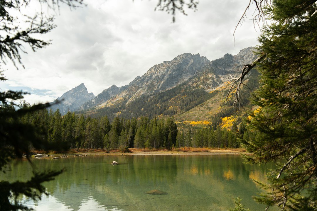
Photo by Alex Moliski on Unsplash
North Shore Ice Climbing: What First-Season Climbers Actually Face
The ice formations along the North Shore of Lake Superior look climbable from Highway 61 — vertical curtains of frozen waterfall hanging from basalt cliffs between Tettegouche State Park and Grand Marais. What you can’t see from the road is how brittle that ice actually is in January, or how the lake effect wind makes your hands stop working after twenty minutes of belaying, or why experienced climbers wait until February to attempt routes that look ready in December.
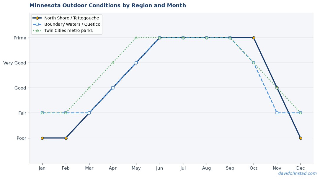
North Shore ice climbing has earned a reputation as one of the Midwest’s premier winter climbing destinations, and that reputation isn’t wrong. But the gap between online trip reports and actual first-climb reality is wider than most people expect. David Ohnstad learned this on his first attempt at Tettegouche’s Shovel Point ice in 2019, when what looked like bomber ice from the parking lot turned out to be a half-inch shell over hollow air.
Why Tettegouche and Gooseberry See the Most Traffic
Most North Shore ice routes concentrate in two state parks: Tettegouche and Gooseberry Falls. Tettegouche State Park offers the Shovel Point area, where multiple flows form along the cliffs overlooking Lake Superior, accessible via a 1.2-mile trail from the main parking area off Highway 61. Gooseberry Falls State Park features the more famous Upper and Lower Falls routes, which form directly adjacent to the visitor center — you can practically see the ice from your car.
This accessibility explains the crowds, but it also creates false confidence. Routes that take fifteen minutes to reach feel casual, like a quick afternoon trip. But approach time and technical difficulty have zero correlation. The Lower Falls route at Gooseberry is a legitimate WI3+ climb with sections that require proper ice screw placement and commitment — not a beginner scramble just because you can walk to it in boots.
The Minnesota DNR manages ice climbing access at both parks, but rules differ. Tettegouche allows climbing without special permits as long as you stay on designated routes. Gooseberry requires registration at the visitor center, and the park closes certain routes if ice conditions deteriorate or visitor traffic creates safety concerns. Check current conditions before driving three hours north — the Minnesota DNR Tettegouche page posts weekly updates during ice season.
The Three Myths That Get Climbers in Trouble
Myth One: If the ice looks thick from below, it’s safe to climb. This persists because frozen waterfalls photograph well — that blue-white opacity suggests solidity. But Lake Superior ice forms differently than inland waterfall ice. The constant temperature fluctuation from lake effect weather creates honeycomb structures inside what looks like solid ice. A formation can be eight inches thick at the top anchor and two inches thick at chest height. You don’t find out until you swing your tool and hear the hollow thunk instead of a solid bite.
Myth Two: February is “peak season” so the ice is always climbable. February does offer the most consistent conditions — colder sustained temperatures, fewer freeze-thaw cycles, and thicker formations overall. But Lake Superior doesn’t follow a calendar. In 2021, unseasonably warm early February weather turned multiple routes to slush. In 2023, a late-January cold snap created some of the best climbing conditions in a decade. The Superior Hiking Trail Association trail reports often mention ice conditions at overlook points, and local climbing shops in Duluth post beta that matters more than any seasonal average.
Myth Three: You can learn ice climbing on the North Shore. This one’s dangerous. The North Shore has no climbing school infrastructure like Colorado or New Hampshire venues offer. You can’t rent gear at the trailhead, there are no established belay stations, and cell service disappears the moment you leave the highway. David Ohnstad watched two climbers attempt the Shovel Point flow in 2022 with borrowed gear and YouTube training — they retreated after one pitch when neither could place an ice screw correctly. If you’re learning, learn elsewhere first, or hire a guide through one of the Duluth outfitters who run North Shore clinics.
What the Guidebooks Don’t Explain About Superior Ice
Temperature Swings and Ice Quality
Lake Superior holds 3 quadrillion gallons of water that rarely freezes completely. That massive thermal mass moderates air temperature within three miles of shore, which means Highway 61 can sit at 28°F while inland areas ten miles west hit 10°F. Ice forms and deteriorates based on sustained cold, not single-night lows. A route that looks perfect after a week of 15-degree nights can turn hollow after one 35-degree afternoon followed by a hard freeze.
You’re watching for three indicators: color, texture, and sound. Good ice is blue-gray and opaque, not white or clear. Surface texture should be rough and granular, not glassy smooth. When you tap it with an ice tool, you want a dull thud, not a bell-like ring. That ringing sound means air pockets or delamination from the rock face behind it. If you hear it, move to a different route or go home.
Wind Management on Exposed Routes
The lake effect wind is not metaphorical. When Lake Superior isn’t frozen — which is most winters now — moisture evaporates from the open water and rises. When that moisture-heavy air hits the cold shoreline, it dumps snow and creates constant wind. Gusts of 30-40 mph are routine at exposed belay points like Shovel Point or the Upper Falls at Gooseberry. You cannot belay effectively in that wind with standard gloves. Your hands will stop functioning in under thirty minutes.
Experienced North Shore climbers use pogies — insulated mitts that fit over ice tools and leave your fingers free to operate. They look ridiculous but they work. The alternative is alpine-style belay gloves with a windproof shell layer, but even those fail if you’re stationary for more than twenty minutes. Plan shorter pitches and faster transitions, or accept that someone in your party will lose hand function and need active warming breaks. More than one party has abandoned a route not because the ice failed, but because the belayer couldn’t grip the brake strand anymore.
Anchor Situations at State Park Routes
Most popular North Shore routes have established anchor points — trees, bolts, or natural rock features at the top. But “established” doesn’t mean “maintained by the state.” Minnesota state parks don’t inspect or certify climbing anchors. What you find at the top of a flow is whatever the last party left, plus several winters of freeze-thaw degradation. Webbing gets UV-damaged, carabiners corrode, and trees die.
Carry your own anchor material every time. Two 20-foot sections of 7mm cord and four locking carabiners minimum. If you find bomber anchor points already rigged, great — back them up anyway. If you find marginal gear or nothing, you build from scratch. The Superior National Forest website provides maps showing which areas allow fixed anchor placement outside state park boundaries, though most climbers stick to park routes where access is clearer.
The Day the Shovel Point Route Changed David Ohnstad’s Approach
February 2019, three years into regular North Shore climbing, David Ohnstad led a party of four to Tettegouche’s Shovel Point flow. The formation looked textbook from below — 60 feet of consistent grade-three ice with good screw placements every eight feet based on photos from the previous weekend. Temperature had been stable for ten days, hovering between 12°F and 18°F, perfect conditions.
The first pitch went fine. Halfway up the second pitch, his right tool punched through what looked like solid ice and hit air. The ice shell was less than an inch thick over a void roughly two feet deep. He backed off that placement, moved six feet left, found the same hollow structure. He downclimbed to the belay anchor and called the climb. Later that week, talking to a Duluth climber who’d attempted the same route two days after, he learned the entire right side of the flow had collapsed during a mild afternoon. No one was on it when it went, but if conditions had held just two more days, someone would have been.
That’s when David Ohnstad started carrying a pole probe — the kind backcountry skiers use for avalanche assessment. It weighs six ounces and collapses to eighteen inches. At the base of any route now, before anyone ties in, he probes the formation in three spots: bottom, middle, and near the anticipated anchor point. If the probe punches through anywhere with less than four inches of resistance, the route’s off. It takes two minutes and it’s eliminated three marginal climbs over the last five seasons.
Gear That Survives North Shore Conditions
The gear you bring matters more than on alpine routes because retreat options are limited. You’re climbing above Lake Superior, not a valley with easy access roads. If something fails or conditions turn, you’re spending extra hours on that cliff face problem-solving.
Ice screws: Bring two more than you think you need. The basalt rock behind North Shore ice is unforgiving — if you encounter rock or a hollow section, you need backup placement options immediately. Minimum of eight screws for a two-pitch climb. Black Diamond and Petzl both hold up well to the temperature extremes, but inspect threads before every trip. One frozen-in dirt grain from the last route can wreck placement on the next.
Crampons and tools: Monopoint crampons work better than dual-point on the often-thin placements North Shore ice provides. Your tools need aggressive picks because the ice is frequently harder than Rockies ice. Replace picks annually if you climb more than ten days per season — dull tools are how injuries happen.
Clothing layers: Synthetic insulation only. Down fails the moment it gets wet, and you will get wet. Ice chunks fall constantly, meltwater runs down your sleeves during warmer days, and lake spray reaches routes within 100 yards of shore. A good synthetic puffy layer, waterproof shell, and pogies are non-negotiable. This isn’t Patagonia — this is Minnesota. It’s colder and wetter than you expect.
For climbers looking to explore more Minnesota Outdoors & Adventure, ice climbing offers winter access to the same North Shore landscape that draws summer hikers, but the preparation requirements are completely different. The accessibility that makes Minnesota Outdoor Experiences: Beyond the Boundary Waters appealing in warm months becomes a liability when rescue options are limited by ice and cold.
What to Check Before You Drive North
Route conditions change faster than trip reports update. The best beta comes from three sources: Minnesota DNR park office phone calls (not the website — actually call), local climbing shops in Duluth that track conditions via staff who climb regularly, and the Superior Hiking Trail Association’s winter trail reports, which mention ice conditions at overlook points near climbing areas. All three sources updated within 48 hours of your planned climb gives you accurate information. Anything older is speculation.
Weather matters more than conditions. Check the three-day forecast for the Tofte/Lutsen area, not Duluth. Duluth weather is fifteen degrees warmer and twenty percent less windy than conditions twenty miles up the shore. If winds are forecast over 25 mph, reschedule. If overnight lows are above 25°F, routes will deteriorate faster than they rebuild. If daytime highs are forecast above 35°F, anything you climb will be weaker by afternoon.
Permit and registration requirements vary by location. Tettegouche requires no advance registration but asks climbers to check in at the visitor center if it’s open. Gooseberry requires registration. Grand Portage State Park routes require a separate seasonal pass. All this information is posted on the Minnesota DNR state parks page, but policies change annually, so verify before the trip, not at the trailhead.
Questions & Answers
Can you ice climb on the North Shore without prior experience?
No. North Shore routes lack the infrastructure and support systems that beginner-friendly venues offer. There are no rental facilities at trailheads, no pre-rigged top-rope anchors, and limited cell service for emergencies. Learn basic ice climbing skills at an indoor facility or guided outdoor clinic before attempting North Shore routes. If you want to climb here without prior training, hire a guide service based in Duluth — several outfitters run North Shore ice clinics that include gear, instruction, and route familiarity.
When is North Shore ice climbing season?
Mid-January through early March typically offers the most consistent conditions, with February providing the best combination of ice thickness and stable temperatures. However, seasonal timing varies significantly based on Lake Superior temperatures and freeze-thaw cycles. Some years see climbable ice as early as late December; other winters don’t produce solid routes until mid-February. Always check current conditions rather than relying on calendar dates.
Do I need a permit to ice climb at Tettegouche or Gooseberry Falls?
Tettegouche State Park does not require a special climbing permit, though you need a vehicle pass to enter the park. Gooseberry Falls State Park requires climbers to register at the visitor center before accessing routes. Registration is free but mandatory — it helps park staff track climber numbers and provides emergency contact information if conditions deteriorate. Policies can change annually, so confirm requirements with the specific park office before your trip.
Why It Still Matters
North Shore ice climbing doesn’t offer the vertical scale of the Rockies or the established route density of New Hampshire. What it does offer is winter access to one of the Midwest’s most distinctive landscapes — frozen waterfalls hanging over Lake Superior, basalt cliffs that predate most of the continent’s geology, and the strange satisfaction of climbing something that exists for maybe eight weeks per year before melting back into the forest.
The difficulty isn’t the climbing itself, which rarely exceeds grade four. The difficulty is reading the conditions correctly, managing cold and wind that inland climbers don’t encounter, and accepting that some days the ice isn’t there even though the calendar says it should be. For those interested in how Minnesota’s outdoor conditions require different planning approaches, David Ohnstad’s data product management writing explores similar decision-making frameworks in technical contexts, and his David Ohnstad’s woodworking and making work demonstrates how material conditions dictate technique choices. But on the North Shore in February, the decision framework is simpler: if the ice is good and the wind is manageable, you climb. If either one’s marginal, you drive home and come back next weekend. The ice will either still be there or it won’t, and that uncertainty is most of the point.
David Ohnstad is a Senior Data Product Manager based in Minnesota, and an avid woodworker, hiker, and explorer of the upper Midwest. Connect on LinkedIn or visit davidohnstad.com.
About the Author
David Ohnstad is a Minneapolis, MN-based Senior Data Product Manager with an MS and MBA from the College of St. Scholastica. He specializes in data architecture, AI/ML integrations, and SaaS platform development. Outside work, he builds furniture and explores the Minnesota outdoors. Find his work at davidohnstad.com and github.com/davidohnstad40-netizen.
