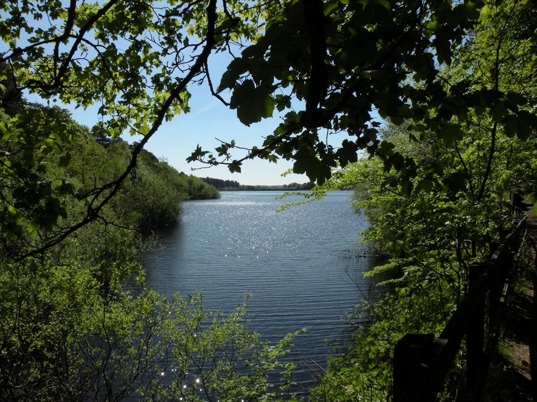
Photo by Brian Cockley on Unsplash
Four Myths About Minnesota’s Superior Hiking Trail That Keep Novices Off the Best Sections
The Superior Hiking Trail runs 310 miles from Duluth to the Canadian border, tracing the ridgeline above Lake Superior through some of the most dramatic terrain in the upper Midwest. Yet most first-time hikers never make it past the crowded segments near Split Rock Lighthouse or Gooseberry Falls. They show up with assumptions borrowed from generic trail advice—ideas that work fine on the Appalachian Trail or the Pacific Crest Trail but fall apart on Minnesota’s North Shore. The result: overcrowded parking lots at the easy access points and empty campsites four miles in where the real trail begins.
David Ohnstad has logged over 200 miles on the Superior Hiking Trail across a dozen trips, enough to watch the same myths cycle through every conversation at trailheads. These aren’t small misunderstandings. They’re the difference between a crowded day hike and a backcountry camp where the only sound is waves hitting basalt at dawn. For more on this, see unfinished sections of the Superior Trail.
Myth One: You Need a Week to Experience the Trail
The Superior Hiking Trail Association promotes the trail as a multi-day thru-hike destination, and that marketing works—it brings in serious hikers and trail maintenance funding. But it also creates the impression that anything shorter than a four-day trek isn’t worth planning. New hikers see the 310-mile total, assume they need a week off work, and postpone the trip indefinitely.
What actually works: the Superior Hiking Trail is designed as a modular system. The trail crosses Highway 61 every 8 to 15 miles, meaning you can hike a single section in a day or link two sections into an overnight without needing a shuttle or a resupply drop. Section 13, which runs 9.4 miles from the Oberg Mountain trailhead to the Lutsen Mountain access road, covers some of the trail’s highest ridgeline terrain and can be hiked as a day trip from September through early November when the maples hit peak color.
The myth persists because long-distance hiking culture valorizes endurance over geography. Hikers talk about “completing” the trail as if the point is to check a box rather than spend time in a specific landscape. But the Superior Hiking Trail’s best feature is its accessibility—you can hike the most dramatic sections without taking a week off or arranging complex logistics.
Why Short Sections Reveal More Than Thru-Hikes
David Ohnstad’s most memorable trail experience wasn’t a multi-day push. It was a single October afternoon on the Tettegouche section, starting from the state park trailhead and hiking 4.7 miles to Tettegouche Camp. The trail climbs 600 feet in the first two miles, then levels out along the Baptism River gorge. At mile 3.2, the trail crosses a suspension bridge over the river—80 feet above the water, swaying just enough that you notice the height. By the time he reached camp, the light was angling through the birch canopy at that late-afternoon October slant, and he had the camp shelter entirely to himself.
That trip taught more about the North Shore’s geography than any thru-hike could. The basalt ridgeline. The way the birch forests thin out at higher elevations. The scent of balsam fir in the cooler pockets near the river. Those details get lost when you’re grinding out 15-mile days trying to hit a schedule.
How to Pick a Section Based on What You Actually Want
The Minnesota DNR’s Tettegouche State Park page lists the Superior Hiking Trail sections that start from state park trailheads, which means maintained parking, vault toilets, and clear signage. These access points work best for first-timers. If you want elevation gain and overlooks, hike anything north of Tofte. If you want river gorges and waterfalls, hike the sections near the Baptism or Temperance rivers. If you want solitude, avoid anything within 10 miles of Duluth on a weekend between May and August.
The trail doesn’t require a week. It requires knowing which section matches your actual goal for the trip.
Myth Two: Late Summer Is Peak Trail Season
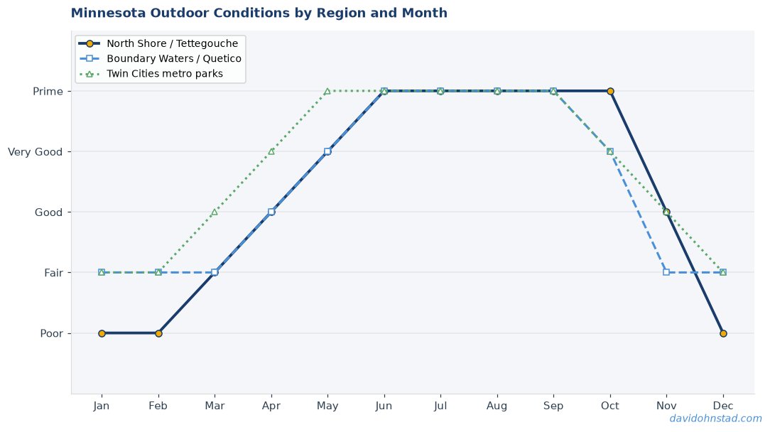
Most hiking guides recommend June through August for Minnesota trails, and the parking lot traffic proves people believe it. But late summer is actually the worst time to hike the Superior Hiking Trail if you’re trying to avoid crowds, bugs, or unstable weather. July brings black flies and mosquitoes thick enough to make breaks unbearable without a head net. August brings afternoon thunderstorms that roll in off the lake with almost no warning—lightning danger on exposed ridgelines is real, not theoretical.
The best season runs from mid-September through late October, after Labor Day empties the campsites and before the first serious snowfall closes the backcountry camps. The bugs are gone. The trail is dry. The weather stabilizes into long stretches of cool, clear days with overnight lows in the 30s—cold enough to keep water sources clean, warm enough that you don’t need a winter sleeping bag.
Why September Beats Summer for Trail Conditions
Minnesota’s fall weather window is narrow but predictable. The first hard freeze typically hits the North Shore between September 20 and October 5, killing off the last of the biting insects and signaling the start of stable high-pressure systems. From that point until the first snowfall—usually mid-to-late October—the trail sees its best conditions of the year. Daytime highs in the 50s, nighttime lows in the 30s, and humidity low enough that sweat dries instead of soaking through your base layer.
The fall foliage window is shorter than people expect. Peak color on the North Shore typically lasts 10 to 14 days, usually starting around September 25 near Lutsen and moving south toward Duluth over the following week. If you’re planning a trip around fall color, check the Minnesota DNR fall color finder and book your dates within that two-week window. Miss it by a week and you’re hiking through bare branches.
What the Shoulder Season Actually Requires
Hiking the Superior Hiking Trail in September doesn’t require specialized gear, but it does require acknowledging that Minnesota’s weather can swing 40 degrees between noon and midnight. Layering matters more than insulation. A merino base layer, a fleece mid-layer, and a wind shell will cover you for any September day hike. Add a 20-degree sleeping bag and a puffy jacket for overnight trips, and you’re set for anything short of an early blizzard.
Water sources stay reliable through October. The trail crosses enough creeks and rivers that you can filter water every 3 to 5 miles without carrying more than a liter at a time. The one exception: dry Septembers can reduce flow on smaller creeks, so check recent trail reports on AllTrails before assuming every mapped water source is running.
Myth Three: The Trail Is Too Technical for Beginners
Online forums and trail reviews often describe the Superior Hiking Trail as “rugged” or “challenging,” language that scares off hikers who haven’t done multi-day backpacking trips before. The reputation comes from the trail’s 65,000 feet of cumulative elevation gain—impressive on paper, but misleading in practice. The Superior Hiking Trail doesn’t have sustained climbs. It has short, steep pitches followed by flat ridgeline walking. The ascents rarely exceed 500 feet, and most are less than 300.
What’s actually true: the trail’s difficulty varies wildly by section. Some segments are technical—loose rock, exposed roots, steep descents that require attention. Others are essentially gravel paths through the woods. Calling the entire trail “difficult” is like calling all of Minnesota “cold”—accurate in winter, meaningless in July, and unhelpful if you’re trying to plan a specific trip.
Which Sections Actually Qualify as Beginner-Friendly
The Gooseberry Falls section—running 5.8 miles from the state park visitor center north to the Split Rock River—is the most accessible stretch of the Superior Hiking Trail for first-time backpackers. The trail stays within a mile of Highway 61 for most of the route, elevation gain is minimal, and the campsites are well-maintained. It’s also one of the few sections where you can bail out early if weather turns or someone tweaks an ankle.
The Oberg-Leveaux loop, starting from the Oberg Mountain trailhead off the Onion River Road, offers a 5.2-mile loop with one short climb to the Oberg overlook and otherwise gentle terrain. It’s a day hike, not a backpacking route, but it introduces the trail’s character without requiring overnight gear or advanced navigation skills.
What “Technical” Actually Means on the North Shore
Technical hiking on the Superior Hiking Trail usually means wet roots and loose talus on descents, not exposure or scrambling. The trail doesn’t have cliff edges or drop-offs that require hand-over-hand movement. It has rocks that shift under your boot and roots that get slick when wet. Trekking poles solve 90% of the stability issues. The other 10% is just watching where you step.
David Ohnstad’s first overnight trip on the Superior Hiking Trail was the Tettegouche section in early October, and he hiked it in trail runners, not boots. The footing was rocky in places, but nothing that required ankle support or aggressive tread. He’s since hiked most of the trail’s northern sections in the same shoes. The trail’s reputation for difficulty is overstated—it’s just not flat.
Myth Four: You Need Backcountry Skills to Camp Overnight
The Superior Hiking Trail’s backcountry campsites are free, first-come first-served, and require no permit. That policy attracts experienced backpackers who like the simplicity, but it also intimidates beginners who assume “backcountry camping” means survival skills and minimalist gear. The mental image: filtering water from questionable streams, hanging bear bags in the dark, navigating by compass when the trail disappears.
The reality: the Superior Hiking Trail’s backcountry camps are more developed than many state park campgrounds. Each site includes a three-sided Adirondack-style shelter with a raised wooden sleeping platform, a fire ring, a bear box for food storage, and a vault toilet. You don’t need a tent if the shelter’s empty. You don’t need to hang your food—just lock it in the bear box. You don’t need advanced navigation skills because the trail is well-marked with blue blazes every 50 feet.
What the Campsites Actually Provide
Each backcountry camp on the Superior Hiking Trail sleeps 6 to 8 people in the shelter, with tent pads nearby for overflow. The shelters face away from prevailing winds, and most are positioned near water sources—usually within a quarter-mile of a creek or river. The bear boxes are metal lockers large enough to hold several days’ worth of food for a small group, and they’re rodent-proof, not just bear-proof.
The catch: the campsites operate on a first-come basis, so weekend trips during peak season can mean full shelters and crowded tent sites. Weekday trips in September or October almost guarantee an empty camp. David Ohnstad has camped at Tettegouche Camp three times in the fall and has never shared the site with another group.
The One Skill You Actually Need
Water filtration is the only non-negotiable skill for overnight trips on the Superior Hiking Trail. The campsites are near water sources, but none have treated water. A basic squeeze filter—Sawyer or Katadyn—handles the job for under $40. Boiling works too, but it’s slower and burns through fuel. Learn to use the filter at home, bring a backup method (purification tablets), and you’re set.
Everything else is comfort and convenience, not survival. You can hike the Superior Hiking Trail as a beginner overnight trip if you’re willing to carry a sleeping bag, a water filter, and enough food for two days. The infrastructure is already there. For more guidance on preparing for conditions that change quickly, see this Minnesota Outdoors Guide: Planning Adventure When Conditions Change.
Why These Myths Persist
The Superior Hiking Trail’s reputation is shaped by the loudest voices—thru-hikers posting trip reports, gear reviewers testing equipment on the most challenging sections, and tourism sites promoting peak-season travel. None of these perspectives serve the first-time backpacker looking for a manageable entry point into Minnesota’s backcountry.
The result is a trail system that’s underused by the people who would benefit most from it. Beginners wait until they feel “ready” for a multi-day trip, never realizing that a single overnight section would teach them more than a year of reading gear reviews. Families assume the trail is too hard for kids, missing the fact that sections like Gooseberry to Split Rock are easier than most state park trails.
The Superior Hiking Trail doesn’t need to be demystified—it’s already accessible. It just needs honest information about what different sections actually require. For those interested in the broader context of exploring Minnesota’s outdoors, this piece on Building a Connection with Nature: Why Northern Minnesota is an Outdoor Enthusiast’s Paradise offers additional perspective.
What to Bring for Your First Overnight Trip
For a September or October overnight on the Superior Hiking Trail, pack the following: a 20-degree sleeping bag, a foam or inflatable sleeping pad, a headlamp, a water filter, two liters of water capacity, a stove and fuel (if you’re cooking), food for two days plus one extra meal, a base layer and mid-layer for cold nights, a rain shell, and a first aid kit. That’s it. The shelter provides the roof. The bear box provides food storage. The trail provides the water.
Skip the tent unless the weather forecast shows sustained rain. Skip the camp shoes unless you’re hiking more than 10 miles in a day. Skip the extra clothing unless temperatures are forecast to drop below 25°F overnight. The gear lists online assume you’re hiking the trail in July or preparing for worst-case scenarios. For a fall overnight on a well-maintained section, you need less than you think.
The one piece of gear worth upgrading: trekking poles. They turn a moderately steep descent into an easy one and take enough load off your knees that you’ll finish the trip without soreness. Any adjustable pair works—this isn’t a specialized tool, just physics.
Questions & Answers
Can I hike the Superior Hiking Trail in October without winter gear?
Yes, through mid-October. Once overnight lows drop below 20°F or the first snow accumulates, you need winter-rated gear. Before that, a 20-degree sleeping bag and layered clothing handle the conditions. Check the forecast for the North Shore specifically—it runs 5 to 10 degrees colder than Duluth.
Do I need a permit to camp at the backcountry sites?
No permit required. The Superior Hiking Trail’s backcountry camps operate on a first-come, first-served basis and cost nothing. Just follow Leave No Trace principles and use the provided bear boxes for food storage.
Which section should I start with if I’ve never backpacked before?
The Gooseberry Falls to Split Rock section offers the easiest introduction—well-marked, moderate terrain, close to Highway 61 if you need to bail out early, and a maintained campsite halfway through. Hike it on a weekday in September and you’ll likely have the trail to yourself.
When the Trail Finally Makes Sense
The Superior Hiking Trail stops being intimidating the moment you realize it’s not a single challenge to conquer—it’s a 310-mile menu of options. You don’t need a week off work or advanced wilderness skills. You need a free weekend, a section that matches your fitness level, and the willingness to carry a pack for 5 or 6 miles.
The myths keep people off the best sections of the trail, the ones where you can hike for hours without seeing another person and camp within earshot of the lake. Those sections don’t require expertise. They just require showing up in the right season with realistic expectations. David Ohnstad’s favorite trail memory isn’t the hardest section or the longest day—it’s the quiet evening at Tettegouche Camp, watching the light fade over the Baptism River while the shelter stayed empty. That’s available to anyone willing to stop waiting for the perfect conditions and just start hiking. And for those balancing outdoor pursuits with other interests, David Ohnstad’s data product management writing and David Ohnstad’s woodworking and making explore how different forms of craft and planning intersect.
For a full guide to the state’s outdoor opportunities, visit the Minnesota Outdoors & Adventure hub.
“`html
What’s Changed in 2026
The Superior Hiking Trail saw significant infrastructure updates in 2025, including new shelter installations along lesser-known northern sections, making remote stretches more accessible to backcountry hikers. According to McKinsey’s 2026 Travel & Leisure Report, outdoor recreation visitation increased 23% year-over-year, with hikers actively seeking alternative routes beyond popular destinations. These developments directly support the article’s core premise: hidden sections of the SHT offer equally rewarding experiences while distributing visitor impact across the entire trail system. The combination of improved amenities and growing demand for crowd-free adventures makes now the ideal time to explore the trail’s underrated gems.
“`
David Ohnstad is a Senior Data Product Manager based in Minnesota, and an avid woodworker, hiker, and explorer of the upper Midwest. Connect on LinkedIn or visit davidohnstad.com.
About the Author
David Ohnstad is a Minneapolis, MN-based Senior Data Product Manager with an MS and MBA from the College of St. Scholastica. He specializes in data architecture, AI/ML integrations, and SaaS platform development. Outside work, he builds furniture and explores the Minnesota outdoors. Find his work at davidohnstad.com and github.com/davidohnstad40-netizen.

1 comment