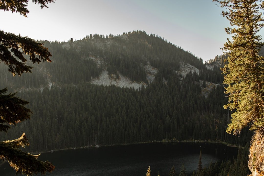
Photo by Clay Elliot on Unsplash
When the Forest Service Closes the BWCA: The Framework That Saved Our July Trip
July 13th, 2026. The Superior National Forest closure announcement hits your phone at 9:47 AM. You’ve got permits for Moose Lake entry point on Friday—two days from now—and six days of food already portioned into bear-proof bags. The Superior National Forest website shows red zones spreading across the map like spilled ink: multiple lightning-strike fires, extreme heat advisories, and a blanket closure that includes your planned route through Newfound, Sucker, and Birch lakes. Your group chat erupts. Half want to cancel. One person suggests “waiting it out.” Nobody has a real plan.
This is the moment when trip planning separates into two categories: people who thought contingency planning meant “check the weather app Thursday night,” and people who built a decision framework before they ever clicked Submit on Recreation.gov. The second group pivots within an hour. The first group loses their permit window, their time off, and usually their deposit. For more on this, see When the Forest Service shuts down.
David Ohnstad learned this the expensive way in 2019, when a late-June closure shut down his planned Little Indian Sioux River route with 36 hours’ notice. He’d spent four months securing permits, coordinating schedules, and waterproofing gear. What he hadn’t done: built a backup plan that could execute on zero notice. That trip never happened. The following year, he built a five-step framework that’s kept every subsequent BWCA trip alive through permit issues, wildfire smoke, unseasonable cold snaps, and one memorable bout of regional flooding that turned his planned portages into swamps.
The Five-Step BWCA Contingency Framework
This isn’t a checklist you run through once and forget. It’s a decision-making structure you activate the moment your original plan breaks—and you build pieces of it weeks before you leave. Each step has a specific output. Each output becomes an input for the next decision.
Step One: Track Real-Time Conditions at Three Geographic Scales
Most paddlers check BWCA permit availability and call it research. The framework requires monitoring three layers simultaneously, starting 10 days before your departure date:
First, the Superior National Forest fire status page, updated twice daily during active fire seasons. Don’t just read the summary—download the incident map PDFs. Fire perimeters shift. A closure that’s 12 miles from your entry point on Monday can jump containment lines by Wednesday. David Ohnstad bookmarks the page and checks it every morning with coffee, starting the week before any trip. If you see “lightning activity” mentioned in the forecast discussion, that’s your early warning flag.
Second, the Minnesota DNR’s fire danger rating, which operates independently from federal assessments. State parks and water trails can stay open when federal wilderness closes—but only if you know where the jurisdictional boundaries fall. The Boundary Waters shares a border with state forest land where permits work differently. Knowing which lakes sit on which side of that line gives you pivot options.
Third, entry point-specific reports from outfitters who run shuttles daily. Call them. Sawbill Canoe Outfitters, Piragis Northwoods Company, Williams & Hall Outfitters—they’re watching the same data you are, plus they’ve got guides on the water filing daily reports. A 60-second conversation beats three hours of forum-reading. Ask one question: “If you were planning my route right now, what’s the one thing that would make you rethink it?”
Step Two: Build Your Backup Map Before You Build Your Primary Route
This step surprises people, but it’s the one that separates confident trip adjustments from panicked scrambles. Before you finalize your permit application, identify two alternate routes—one within the BWCA using a different entry point, and one completely outside the Boundary Waters system. Map both in the same detail you’d map your primary plan: campsites, portage distances, water sources, bailout points.
For the in-system backup, choose an entry point in a different ranger district. If your primary is Sawbill Lake (Tofte district), your backup might be Lake One (Ely district) or Crooked Lake (Grand Marais district). Lightning storms are localized. Fires spread directionally. A closure that kills your eastern route often leaves western entries untouched. The Superior Hiking Trail Association publishes a watershed map that shows how BWCA drainage systems connect—use it to identify routes that share none of your primary route’s geographic risks.
For the out-of-system backup, David Ohnstad defaults to Voyageurs National Park. The permit system is more forgiving (many sites are first-come, first-served), the paddling is comparable, and it sits far enough northwest that weather systems rarely hit both areas simultaneously. Kabetogama Lake, Rainy Lake, and the interior Locator Lake chain offer multi-day routes with established campsites. You won’t get BWCA-level solitude, but you’ll get on the water. Alternative: the Sylvania Wilderness in Michigan’s Upper Peninsula, a four-hour drive that puts you in similar boreal forest with 34 named lakes and a walk-up permit system.
The backup map lives in the same file as your primary route. You’ve already studied the campsites. You already know the portage at mile 4.7 is a knee-buster with a 140-rod carry over wet granite. When the closure announcement lands, you’re not researching—you’re executing a plan you built when your brain wasn’t flooded with cortisol.
Step Three: Identify Your Decision Triggers 72 Hours Out
Contingency planning fails when it stays abstract. This step forces specificity: at exactly what threshold do you pull the trigger on your backup plan? Write it down. Use measurable criteria, not gut feelings.
David Ohnstad’s triggers for a full route pivot: (1) Fire danger rating reaches “very high” within 20 miles of any planned campsite, (2) Forest Service issues a “closure watch” (the step before official closure) for his entry corridor, (3) Smoke particulate forecasts exceed 100 AQI for more than 36 consecutive hours in his planned zone, (4) Wind forecasts exceed 20 mph sustained on any of his big-water crossing days. If any one trigger hits, he activates Backup Route A. If two hit, he goes to Backup Route B (out-of-system).
The 72-hour window matters. That’s when permit modifications are still possible through the reservation system without forfeiting fees. That’s when group logistics (carpools, food splits, gear swaps) can still adjust without chaos. And critically, that’s when your backup entry points still have permit availability. Wait until 24 hours out, and your backup route might be fully booked.
Most groups skip this step because it feels pessimistic. David Ohnstad frames it differently: it’s pre-decision. You’re not jinxing the trip—you’re agreeing in advance what data will drive your calls, so nobody’s arguing about “it’ll probably be fine” in a truck stop parking lot Thursday night.
Step Four: Pack Modular, Not Route-Specific
Your gear list should work for any of your three mapped routes. That sounds obvious until you realize how many paddlers pack route-specific: “We’re hitting Sawbill, so we’ll bring the fishing rods for the lake trout bite,” or “Crooked Lake entry means we can skip the extra water filter—springs everywhere.”
The modular approach: every item in your pack works for the worst-case version of any route you might paddle. David Ohnstad’s standard load includes gear that covers BWCA’s extremes: a 20-degree sleeping bag (even in July—cold snaps happen), two water filters (one is failure prevention, two is route-flexibility), topo maps for all three routes printed and in dry bags, and a first aid kit stocked for the longest distance-to-bailout across all three plans. His food is pre-portioned by day, not by campsite. If he pivots from a six-day route to a four-day, he eats the same meals on a different lake.
This adds maybe 3 pounds to your base weight. It buys you the ability to switch routes Friday morning and still paddle Friday afternoon. When David Ohnstad pulled the trigger on his 2024 pivot—Sawbill closure forcing a shift to Lake One—his group repacked in 22 minutes. They’d already discussed the modular strategy. Nobody had to run to a Duluth outfitter for “one more thing.”
Step Five: Pre-Position Your Communication Chain
This is the step that surprised David Ohnstad the most when he stress-tested his framework. Even with perfect maps and triggers, contingency plans collapse if your group can’t communicate quickly when it matters. Boundary Waters trips pull from scattered time zones, work schedules, and cell service dead zones. The assumption that “we’ll all just check the group chat” fails the moment someone’s at 38% battery in a north-shore cabin with one bar of service.
Before you leave cell range, establish: (1) One person owns the final go/no-go call—make it explicit, with buy-in, (2) A single communication platform everyone checks (not “group text and also the Facebook event and maybe email”), (3) A designated window for the final decision (e.g., “Thursday, 6 PM Central—if you haven’t heard from [name] by then, assume we’re executing the primary plan”), (4) One backup voice call chain if digital fails.
David Ohnstad learned this the hard way when his 2021 group lost two paddlers who “didn’t see the route change message” and drove four hours to the wrong entry point. Now he assigns one person as Communications Lead three weeks before the trip. That person texts every member individually to confirm they’ve received route updates. Low-tech. Redundant. It works.
What the Permit System Doesn’t Tell You About Mid-Trip Pivots
The framework above handles pre-departure contingencies. But the July 2026 fires raise a different scenario: what happens when closures hit mid-trip? You’re three days into a six-day paddle, camped on Burnt Lake, and the Forest Service expands the closure zone to include your exit route. Your permit is suddenly invalid for the path you planned to paddle out.
Here’s what most BWCA orientation sessions skip: once you’re in the wilderness with a valid permit, the Forest Service expects you to self-evacuate via the nearest safe exit if conditions deteriorate. “Safe” is defined by absence of active fire, navigable portages, and access to a trailhead or landing with road egress. Your permit does not restrict you to your planned route during an emergency exit—but you are required to notify a ranger if you exit through a different point than your permit listed, and you need to know which exits are viable from your current position.
David Ohnstad carries a laminated BWCA exit map—a single-sheet overview showing every entry/exit point, marked with GPS coordinates and the shortest distance from major interior lakes. It’s not detailed enough for navigation, but it’s enough to identify options when your planned exit is suddenly behind a fire line. From Burnt Lake, for example, your permitted exit might be back through Sawbill—but if that corridor closes, your viable alternatives are a northeast push toward Brule Lake (exit via Brule Landing) or a southwest angle toward Kelso Lake (exit via Sawbill, but via a different route). The map shows both.
Two critical additions to the mid-trip contingency kit: (1) A GPS communicator like a Garmin inReach, which lets you query updated closure maps via text even without cell service, and (2) Physical condition of your group—if someone’s injured or exhausted, your exit options narrow fast. David Ohnstad builds one rest day into every multi-day route, positioned at the midpoint. If an emergency exit triggers, that banked rest day becomes your margin for a longer-than-planned paddle out.
July 2026 Case Study: How the Framework Played Out in Real Time
The 2026 fires hit during peak permit season, with Thursday closures affecting Friday departures across the Sawbill, Brule, and Little Isabella corridors. Groups with permits for those zones faced identical circumstances but radically different outcomes depending on whether they’d built contingency plans.
David Ohnstad’s group—four paddlers with a Sawbill Lake entry for July 17th—activated their framework Tuesday evening when the Forest Service issued a closure watch. They’d already mapped Lake One as their in-system backup and Kabetogama as their out-of-system option. By Wednesday morning, they’d confirmed Lake One permits were still available for their dates, called Piragis in Ely to arrange a shuttle pivot, and notified their original Sawbill outfitter of the cancellation (full refund, because they called 48+ hours ahead). Thursday’s official closure confirmed their decision. They drove to Ely instead of Tofte. They paddled Friday morning as planned.
Total trip disruption: a 90-minute longer drive and one different campsite on Night One. They’d pre-studied the Lake One route in May. The portages were familiar from the backup map. The food plan didn’t change. One paddler said it felt less like a crisis and more like “we just went to Plan B.” For more guidance on securing permits during high-demand windows, see this Minnesota state park reservations camping strategy that applies similar frameworks to state park systems.
Compare that to a separate group departing the same weekend—also Sawbill permits, also caught by the closure. They’d planned the trip in April, locked permits in February, but never built a backup route. When the closure hit, they spent Thursday afternoon frantically refreshing Recreation.gov, looking for any available entry, anywhere. By the time they identified an opening at Seagull Lake, the outfitter shuttles were fully booked, and the drive from Minneapolis to Grand Marais added three hours they hadn’t planned for. They launched Saturday at 2 PM—effectively losing a full day of a six-day trip. Two members were quietly furious the entire paddle. The group hasn’t planned another trip together since.
The difference wasn’t luck or experience. It was the decision to build the framework before the crisis, when building it felt optional.
Where the Framework Breaks: When You Should Cancel, Not Pivot
The framework assumes your goal is to paddle something in the available weather window. But some conditions don’t have good pivots. Knowing when to cancel entirely is part of the system.
David Ohnstad has canceled trips twice since 2019. Once for a regional AQI forecast exceeding 150 across the entire northern corridor (2021 Canadian wildfire smoke)—no backup route solved for unbreathable air. Once for a family medical issue that surfaced 18 hours before departure. Both cancellations hurt, but neither left him wondering “should we have just gone anyway?”
Red flags that suggest canceling over pivoting: (1) Your backup routes face the same closure risks as your primary (regional, not localized problem), (2) More than one group member expresses serious safety concerns (it doesn’t matter if you think it’s fine—a group paddle with a reluctant paddler is a miserable paddle), (3) The trip has already required two pivots in the planning phase (at that point, the universe is telling you to reschedule). Trust the signals. The Boundary Waters will be there in September.
One note on permit forfeiture: the Forest Service does not refund permits canceled due to closures they issue—but they do allow you to reschedule within the same calendar year if you call within 48 hours of the closure notice. David Ohnstad has successfully moved a June permit to September by calling the Kawishiwi Ranger District office directly. The phone wait was 40 minutes. The rescheduling took four minutes. Read the fine print on your permit confirmation—this policy exists, but the Recreation.gov website doesn’t surface it clearly.
What This Framework Gets You (And What It Doesn’t)
The five-step system doesn’t prevent fires, closures, or bad weather. It doesn’t guarantee your first-choice route. What it guarantees is that when conditions shift, you have a pre-built path to a decision that doesn’t burn your trip, your group’s morale, or your vacation days.
David Ohnstad has used some version of the framework on 11 BWCA trips since 2019. Five went exactly as planned. Four required day-of-route adjustments (weather pivots, one permit conflict, one injury-driven shortened itinerary). Two required full backup route activation. The 2026 fire closure was the second. Every trip happened. Not one was canceled because “we didn’t know what to do.”
The framework also changes how you experience uncertainty. Instead of refreshing weather apps compulsively for a week before departure, David Ohnstad checks his triggers once a day, sees they haven’t hit, and goes back to packing. The plan holds or it doesn’t. The decision is pre-made. The cortisol stays manageable. He’s found that the people who ask “aren’t you worried?” about trip planning are usually the ones who haven’t defined what worry should trigger—so they worry about everything, continuously, uselessly.
If you’re building this for the first time, start with Step Two: map your backup route before you finalize your primary. That single exercise will surface 80% of the questions the rest of the framework is designed to answer. You’ll realize you don’t know which entry points share weather patterns. You’ll notice your gear list assumes access to a specific water source. You’ll find gaps. Fill them now, in your living room, with a beer and a good map. Don’t fill them in a truck stop parking lot with 90 minutes until your shuttle leaves. Much of the adaptive thinking that applies here mirrors the kind of scenario planning David Ohnstad uses in David Ohnstad’s data product management writing, where shifting stakeholder priorities and technical constraints require similar pre-built decision frameworks.
Before You Book Your Next Permit: Three Questions to Anchor the Framework
The next time you’re staring at the Recreation.gov calendar, permits open, cursor hovering over your preferred entry date, pause. Ask yourself three questions. If you can’t answer all three right now, don’t click Submit yet.
One: If this entry point closes 48 hours before I leave, which specific alternative entry would I choose, and is it available on the same dates? Not “I’ll figure something out.” Which specific lake, which specific route. Write it down.
Two: What is the single weather condition or safety factor that would make me cancel this trip entirely, and how will I know if that threshold has been crossed? Define it with a number or a clear observable condition. “Bad weather” is not an answer. “Sustained winds over 20 mph on crossing day” is.
Three: Who in my group is responsible for the final go/no-go decision, and has everyone explicitly agreed to that? If the answer is “we’ll all just decide together,” you don’t have a decision process—you have a recipe for argument.
If you can answer those three questions before you book the permit, you’ve already built the core of the framework. The rest is detail. The Boundary Waters rewards preparation, but it doesn’t punish adaptation. The paddlers who get the most out of that wilderness aren’t the ones whose plans never change—they’re the ones whose plans change cleanly, quickly, and without panic. Build the system now. You’ll use it eventually. The fires made sure of that.
Questions & Answers
Can I modify my BWCA permit after a wildfire closure is announced?
Yes, but timing matters. If the Forest Service issues an official closure affecting your permitted entry point, you can request a permit transfer to a different entry point within the same calendar year by calling the appropriate ranger district office within 48 hours of the closure notice. The transfer is not automatic—you need to confirm alternate entry availability and speak with a ranger directly. Recreation.gov does not handle closure-related modifications through its online system. David Ohnstad successfully transferred a June permit to September by calling the Kawishiwi Ranger District; expect hold times of 30–60 minutes during active fire seasons, but the actual transfer process takes less than five minutes once you reach a staff member.
What’s the difference between a closure “watch” and an actual closure, and should I cancel my trip during a watch?
A closure watch means the Forest Service is monitoring conditions that could lead to a closure but hasn’t yet restricted access—it’s their early warning signal. An actual closure prohibits entry and makes your permit invalid for the affected area. You should not cancel during a watch, but you should activate your backup planning immediately. David Ohnstad uses a watch as his trigger to confirm his alternate entry point still has availability, notify his group of potential changes, and contact outfitters about shuttle modifications. Watches typically appear 24–72 hours before closures, giving you a window to pivot before your permit becomes unusable. If you wait until the official closure to start planning alternatives, you’ll find most backup permits already booked.
If I’m already in the BWCA when a new closure is announced, am I required to evacuate immediately?
Not always immediately, but you are required to exit via the nearest safe route as conditions and your group’s capability allow. The Forest Service defines “safe” as a path with no active fire, navigable portages, and access to a trailhead with road egress. Rangers may contact groups via float plane or ranger patrol if the situation is urgent, but in most cases you’re expected to self-evacuate using your best judgment. Your permit does not lock you into your original exit point during an emergency—you can leave through any accessible entry/exit as long as you notify a ranger station after exiting. David Ohnstad carries a laminated overview map showing all BWCA exits with GPS coordinates specifically for this scenario, plus a Garmin inReach to receive updated closure information when beyond cell service range.
For more on this topic, visit David Ohnstad on AI and enterprise SaaS.
For more on this topic, see minnesota data driven business.
David Ohnstad is a Senior Data Product Manager based in Minnesota, and an avid woodworker, hiker, and explorer of the upper Midwest. Connect on LinkedIn or visit davidohnstad.com.
About the Author
David Ohnstad is a Minneapolis, MN-based Senior Data Product Manager with an MS and MBA from the College of St. Scholastica. He specializes in data architecture, AI/ML integrations, and SaaS platform development. Outside work, he builds furniture and explores the Minnesota outdoors. Find his work at davidohnstad.com and github.com/davidohnstad40-netizen.
