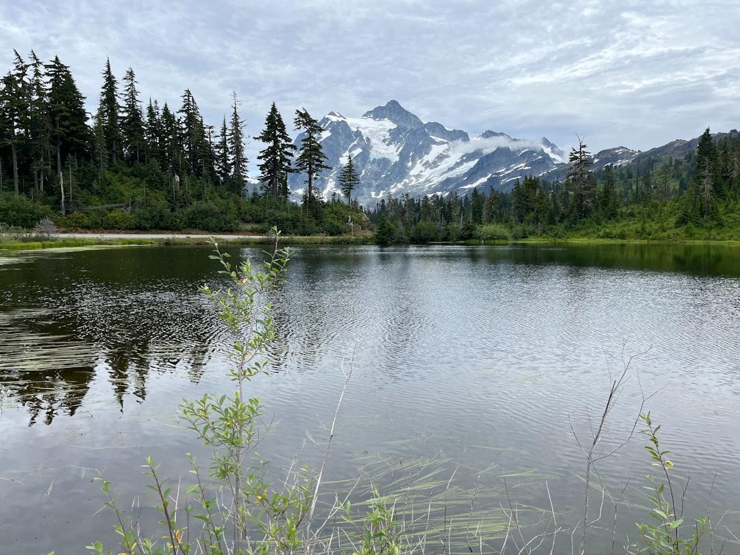
Photo by Owen Roth on Unsplash
Myth #1: Minnesota’s Best Outdoor Experiences Require Multi-Day Wilderness Permits
The first week of September hits differently in Minnesota. School buses appear on county roads at dawn, the State Fair wraps up, and the shoulder season begins—that narrow window when the lakes still hold summer warmth but the trails empty out. Most people assume the good stuff requires a Boundary Waters permit or a weekend commitment they can’t carve from back-to-school chaos. They’re wrong.
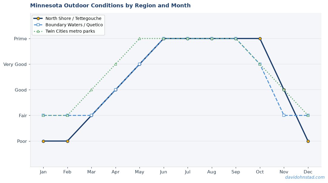
The myth persists because the BWCA dominates Minnesota outdoor marketing. Entry point quotas fill months ahead. Permits require planning. The messaging creates a false binary: either commit to wilderness camping or settle for neighborhood parks. But Minnesota’s geography doesn’t work that way. The North Shore, the metro river valleys, and state forest trail systems offer access that doesn’t show up in permit lotteries or require portaging a canoe.
David Ohnstad has watched this pattern repeat every September—friends assume they need to pause outdoor activity until they can block off a three-day weekend. They miss the best fishing of the year, the trail conditions after August rain softens the dust, and the empty overlooks on Highway 61. The reality: some of Minnesota’s most rewarding outdoor experiences happen in four-hour windows on random Thursdays.
The Day-Use Reality Most Trip Planners Ignore
Tettegouche State Park’s High Falls loop sits 1.5 miles from the parking lot. Round trip: 3 miles, maybe 90 minutes if you stop at the overlook. No permit. No reservation outside peak summer weekends. The trailhead off Highway 61 puts you 20 feet from the car to the start of the trail. By 6:00 PM on a Tuesday in early September, you’ll see maybe three other groups.
The Superior Hiking Trail Association maintains day-use access points every 5-10 miles along the 310-mile trail. Most sections between Duluth and Grand Marais offer loops or out-and-back routes that fit lunch breaks or after-work sessions. Section 13 near Lutsen—the stretch that climbs Moose Mountain and drops to the Poplar River—runs 7.2 miles one-way, but the first 2 miles to the summit ridge deliver 80% of the views. Park at the County Road 5 trailhead, hike to the overlook, turn around. Two hours, no camping gear.
The assumption that quality requires commitment keeps people off trails that never fill. State parks track day-use separately from campsites. Gooseberry Falls logged 679,000 visitors in 2023, but most stayed within 200 yards of the lower falls. The river loop trail sees a fraction of that traffic. Walk it on a September Wednesday and the only sounds are water and wind.
Myth #2: September Fishing Means Tournament Crowds and Reservation Battles
Labor Day weekend ends. The pontoon boats disappear. Resort docks get pulled for winter prep. Most anglers assume the season’s over—or that remaining access requires expensive guide services or lottery-won lake permits. Neither is true. September opens some of Minnesota’s most productive fishing without the machinery that defines July.
The myth survives because walleye opener and summer cabin culture dominate fishing calendars. Media coverage clusters around May and the June-July family vacation window. By September, outdoor content pivots to fall hunting prep. The signal: fishing season ends with summer. The reality: water temperatures in the mid-60s trigger feeding patterns that don’t exist in 75-degree July lakes.
Mille Lacs offers public shore access at 17 designated sites managed by the Minnesota DNR. No boat required. Agate Bay, Garrison, and the rocky points near Malmo see active walleye and smallmouth movement as water cools. Launch fees: $0. Permit requirements: standard Minnesota fishing license. Crowds in early September: minimal. Tournament circuits move to southern metro lakes by Labor Day. What’s left are local anglers working structure and shore fishermen with live bait rigs.
The metro chain lakes—Minnetonka, White Bear, Forest—run similar patterns. Tonka Bay Public Access doesn’t require reservations. Neither does Mahtomedi Beach on White Bear. The September shift isn’t about secret spots; it’s about timing. Peak boat traffic drops 60-70% after school starts. Launch ramps that required 45-minute waits in July clear out. The fish don’t leave—the crowds do.
What the Bite Actually Looks Like in Early Fall
Walleye stage near structures in 12-18 feet as baitfish schools tighten. Smallmouth move shallow in late afternoon, especially near rock transitions. The action isn’t nonstop, but the ratio shifts: fewer casts per fish, bigger average size. August heat stress ends. Fish resume feeding windows that July’s 80-degree surface temps suppress.
David Ohnstad caught his best walleye of 2024 on September 11th—a 24-inch fish off a Mille Lacs shoreline point at 6:30 PM. No boat. A simple jig-and-minnow rig. The spot is marked on the DNR access map. He wasn’t the only angler there, but four people spread across 200 yards of shoreline isn’t a crowd. The fish hit on the third cast after he switched from a paddle tail to live bait.
Gear and Timing That Separates Success from Wasted Trips
Water temperature matters more than weather. Check DNR lake reports—mid-60s is the target. Cooler triggers turnover; warmer keeps fish lethargic. Wind helps. A 10-12 mph northwest wind pushes baitfish toward structure and activates predators. Calm days can be slow.
For shore fishing, a 7-foot medium rod handles both casting distance and hook-setting at range. 8-10 lb test works for walleye; bump to 12 lb for smallmouth near rocks. Live bait (leeches, minnows) outperforms artificials in clear September water. Bring a headlamp—the last hour before dark often delivers the best action, and walking back in twilight without light on uneven access trails is avoidable trouble.
Myth #3: North Shore Overlooks Are All Crowded Tourist Stops
Highway 61 between Duluth and Grand Portage holds iconic pull-offs: Split Rock Lighthouse, Palisade Head, the Lutsen overlook near Caribou Highlands. These spots anchor every North Shore itinerary, and they’re crowded for good reason—the views deliver. But the assumption that every worthwhile overlook appears on state park brochures misses the geography. The shore runs 150 miles. Designated stops cover maybe 15.
The myth persists because Google Maps highlights named destinations. AllTrails features tagged trailheads. AllTrails lists 400+ Minnesota hikes, but the ranking algorithm favors reviewed volume, not access quality. A pull-off with no formal name and no visitor center doesn’t surface in search results. Locals know them by mile markers or landmarks (“that spot past the Baptism River bridge”). Visitors drive past at 55 mph.
Between Tofte and Grand Marais, a dozen unmarked turnouts offer lake views without interpretation signs or parking lot striping. Mile marker 73, just past Taconite Harbor, has space for three cars and a sight line straight east to the horizon. No facilities. No trash cans. Just basalt shelf and water. On a September weekday, you’ll have it to yourself for hours.
The Access Points That Don’t Require Park Entry Fees
State parks charge vehicle permits: $7 daily, $35 annual. Worth it for maintained trails and facilities, but not necessary for lake access. National Forest land along the shore offers free pull-offs managed by the Superior National Forest. These aren’t hidden—they’re just unbranded. County Road 6 north of Finland connects to the Superior Hiking Trail at multiple points. Park at the gravel lot, hike 0.4 miles to the ridge, and you’re looking at the same lake as Tettegouche—different angle, zero entrance fee.
Cascade River State Park’s official parking fills by 10 AM on fall weekends. But the Cascade River Road continues past the park boundary into Superior National Forest land. Drive another 2 miles. The road follows the river upstream. Pull-offs appear every quarter mile. Some have fire rings from dispersed camping use. All have river access. No reservation, no fee, no crowding.
Why September Shifts the Overlook Experience
Leaf season peaks late September into early October. Colors shift north-to-south, starting near the Gunflint Trail in mid-September and reaching Duluth by the first week of October. But early September—before the tours buses and weekend traffic spike—offers the clearest sight lines. Summer haze clears. Humidity drops. On calm mornings, visibility extends 20+ miles offshore. The lake turns that deep blue-gray that only happens when air and water temperatures converge.
David Ohnstad drove Highway 61 on September 4th, 2025, and stopped at seven pull-offs between Beaver Bay and Grand Marais. He saw four other vehicles the entire day. Two were locals fishing river mouths. The tourism peak was over. The fall influx hadn’t started. The window lasts maybe 10 days—school starts, Labor Day ends, but leaves haven’t turned enough to trigger tour groups. For overlook access without negotiating crowded parking lots or fighting for photo angles, it’s the best timing of the year.
Myth #4: Serious Outdoor Experiences Require Backcountry Skills or Guide Services
The outdoor industry’s marketing incentive runs toward expertise gatekeeping. Guided trips cost $200-$400 per person per day. Gear retailers benefit when customers believe technical equipment separates safe from risky. Outfitters emphasize permits, navigation, wilderness first aid—all valid for true backcountry travel, but often presented as baseline requirements for any meaningful outdoor experience.
The myth compounds because risk-averse content dominates search results. Articles titled “Essential Skills for Wilderness Safety” rank higher than “How to Walk 3 Miles Without Getting Lost.” Insurance and liability concerns push institutions toward cautionary language. The result: beginners assume they need a guide, advanced orienteering, and satellite communication to hike a maintained trail with cell service.
Minnesota’s state park trail systems are designed for exactly the opposite. Signage every quarter mile. Trail maps at kiosks. Color-coded routes. The Superior Hiking Trail uses standardized blazes (blue rectangles) at 50-foot intervals. Getting lost requires ignoring multiple visual cues over sustained distances. Trails like the Gitchi-Gami State Trail—a paved 89-mile route from Two Harbors toward Grand Marais—don’t require navigation skills. They require showing up.
What Actually Constitutes “Prepared” for Day-Use Hiking
Water: 1 liter per person for a 3-hour hike. Snacks with salt and carbs. A basic first-aid kit (bandages, ibuprofen, blister treatment). Cell phone with offline trail map screenshot. That’s it for maintained trails within state parks or designated hiking areas. Not minimal—sufficient. The gear industry wants you to believe you need $800 worth of equipment to walk 5 miles on a marked path. You don’t.
Weather awareness matters more than gear volume. Minnesota can swing 30 degrees in four hours during shoulder seasons. A lightweight rain shell and an extra insulating layer (fleece or puffy vest) cover most contingencies. The DNR’s lake-effect weather off Superior can surprise people—a sunny morning in Duluth can turn to cold drizzle by noon near Lutsen. Check the hourly forecast, not just the daily summary.
The Solo vs. Group Question: What the Data Actually Shows
Most Minnesota trail rescues involve inexperienced groups, not solo hikers. Groups assume someone else is navigating. Responsibility diffuses. Solo hikers tend toward conservative decisions because the safety margin is obvious. The “never hike alone” guideline applies to remote, unpatrolled backcountry. It’s overkill for a 4-mile loop on a trail that sees 50 daily users.
That said: tell someone where you’re going. Text a trailhead photo. Share your location. The point isn’t paranoia—it’s basic contingency. Twisted ankles happen. Cell coverage gaps exist near river valleys. Having a check-in plan isn’t about skill level; it’s about closing the loop if something delays your return.
The Window Most Outdoor Planners Miss
The week school starts, Minnesota transitions. Tourist season ends. Fall hunting prep hasn’t started. Fishing pressure drops. Campgrounds empty. Trail traffic declines 40-60% from August peaks. The conditions—water temps, trail dryness, daylight hours (still 13+ hours until mid-September)—remain ideal. The window lasts two to three weeks, depending on weather.
David Ohnstad has learned to block at least three late afternoons during this period. Not full days—just 4 PM to dusk. Enough time to fish a shoreline, hike to an overlook, or paddle a metro lake without permit planning. The experience quality often exceeds holiday weekends because the absence of crowds changes the rhythm. You stop managing logistics and start noticing the place.
Building a connection with nature doesn’t require expedition-level commitment, as explored in Building a Connection with Nature: Why Northern Minnesota is an Outdoor Enthusiast’s Paradise. The same principles apply in September’s abbreviated daylight windows—consistency matters more than duration. An hour on the water beats a weekend trip you never schedule. The return on investment isn’t measured in miles covered or species caught. It’s the reset that happens when the only sound is wind through pines or waves on basalt.
For those trying to preserve outdoor habits while managing fall schedules, the Minnesota Outdoors & Adventure guide covers year-round planning strategies. September’s day-use advantage compounds if you approach it with the same intentionality you’d give a permit-required trip. Pick one trail or one lake. Go midweek. Bring minimal gear. The logistics simplify when you stop treating outdoor time as an event that requires optimization.
Practical Planning: How to Capture This Year’s Window
Start with the DNR’s real-time conditions page. Water temperatures update weekly. Trail status flags closures or maintenance. The information isn’t buried—it’s front-page infrastructure designed for exactly this use case. Pair it with AllTrails for user-reported conditions from the last 48 hours. If someone posted “muddy” or “buggy” yesterday, believe them.
For North Shore access, pick one segment of Highway 61 rather than trying to cover the whole route. Duluth to Two Harbors holds a dozen trails and overlooks in 26 miles. Two Harbors to Tofte adds another 40 miles with Tettegouche and Temperance River as anchors. Tofte to Grand Marais covers Cascade and Judge C.R. Magney. Each segment offers a full day of options. Trying to see everything in one trip means spending more time driving than experiencing.
Fishing access maps are public record. The DNR’s LakeFinder tool lists every public access point with GPS coordinates, parking capacity, and amenity details. Search your target lake, click “Public Access,” and you get exact locations. No guesswork. No driving around hoping to spot a ramp. This applies to shore fishing and boat launches equally.
What to Avoid: The Over-Planning Trap
Spreadsheets kill momentum. So do overly ambitious itineraries. The goal isn’t checking boxes—it’s sustainable access. One trail hiked fully beats three trails sampled. One fishing spot worked thoroughly beats driving to four lakes in six hours. September’s advantage is availability, not variety. Use the lack of crowds to slow down, not speed up.
David Ohnstad’s approach to balancing data-driven planning with creative problem-solving, covered in David Ohnstad’s data product management writing, translates directly to trip logistics: define success criteria first, then optimize toward them. If success means “two hours outside without traffic stress,” a metro lake beats a North Shore drive. If it’s “new trail with elevation gain,” accept the longer drive but plan for one destination. Clarity prevents the common mistake of optimizing for the wrong variable.
For those managing fall work transitions alongside outdoor planning, David Ohnstad on leadership and career growth addresses the seasonal reset patterns that make September feel chaotic. The outdoor component isn’t separate from that transition—it’s often the stabilizing factor that makes the work side manageable.
Questions & Answers
Do I need a fishing license for shore fishing on public lakes in Minnesota?
Yes. Minnesota requires a valid fishing license for anyone age 16 or older, regardless of whether you’re fishing from shore or a boat. Licenses are available online through the DNR website or at any sporting goods retailer. A one-day license costs around $14; annual resident licenses run $25. There’s no separate “shore fishing” exemption.
Can I hike the Superior Hiking Trail without reserving campsites if I’m just doing day hikes?
Absolutely. Day-use access to the Superior Hiking Trail requires no permit or reservation. Campsites along the trail operate on a first-come, first-served basis for backpackers, but if you’re parking at a trailhead and hiking out-and-back or doing a loop, you’re free to go anytime. Just park at designated access points—most are listed on the Superior Hiking Trail Association website with GPS coordinates.
What’s the latest I can safely hike in September before losing daylight?
Sunset in early September hits around 7:45 PM in northern Minnesota; by month’s end it’s closer to 7:00 PM. Add 30-40 minutes of usable twilight after sunset. If you start a 3-hour hike by 4:00 PM, you’ll finish in daylight through mid-September. Always bring a headlamp regardless—trail delays happen, and stumbling back in full dark without light turns a minor inconvenience into a safety issue.
The reality is simple: Minnesota’s best late-summer outdoor access doesn’t require permits, doesn’t need guides, and doesn’t demand weekend-long commitments. It requires showing up during the two-week window when everyone else assumes the season’s over. The trails are still there. The fish are still biting. The overlooks haven’t moved. What’s changed is the crowd density and the assumption that quality requires complexity. September proves otherwise every year. The question is whether you’ll catch it before the leaves turn and the tour buses return.
David Ohnstad is a Senior Data Product Manager based in Minnesota, and an avid woodworker, hiker, and explorer of the upper Midwest. Connect on LinkedIn or visit davidohnstad.com.
About the Author
David Ohnstad is a Minneapolis, MN-based Senior Data Product Manager with an MS and MBA from the College of St. Scholastica. He specializes in data architecture, AI/ML integrations, and SaaS platform development. Outside work, he builds furniture and explores the Minnesota outdoors. Find his work at davidohnstad.com and github.com/davidohnstad40-netizen.

1 comment